

Lac du Bret

No reviews yet
Have you flown here? Share your experience with other pilots.
+ Write the first reviewDescription
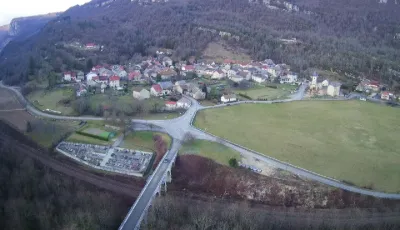
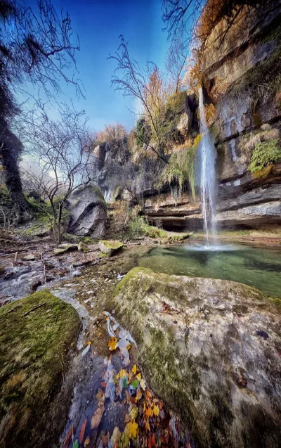
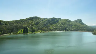
The Bas-Bugey massif is a region of exceptional biological richness. Away from the main roads, it remains well preserved. But it is its landscape that is of the most interest. From the Rhône plain to the summit of the massif (Mollard Dedon, 1219 m above sea level), the elevation difference is nearly 1000 m. The climatic conditions found across the massif are particularly varied and lead to great botanical diversity. The environments found here are as diverse as peat bogs, lakes, mountain forests, dry grasslands, pastures, cliffs... Lac du Bret is tucked away in the middle of the forest. This small body of water is certainly little known to naturalists. Yet a very special magic emanates from the place. The lake is almost entirely covered by aquatic vegetation, with only a small area of open water remaining. The contrast of colors is striking. On the lake, the Little Grebe seems to be one of the only waterbirds breeding here, along with the Eurasian Coot. Several grey herons fish here, but no nest has been seen directly above the water. The European Tree Frog finds more than favorable habitat here, and several males can be heard. A more thorough survey would be worthwhile (amphibians, dragonflies, birds...). Next to the woods, the warm meadows are home to a pair of European Nightjars and a pair of Woodlarks. Nightjar records are quite rare in this area. The Woodlark is more common but finds ideal conditions here in this particularly well-preserved environment.
Map and restricted areas
Open in the main mapNearby aerodromes
Open aerodromes within 25 km of the spot, heliports included, with their distance and direction from the spot. Near an aerodrome, drone flying is prohibited or height-limited: check the UAS zones map.
| Aerodrome | Type | Distance | Elevation | Difference |
|---|---|---|---|---|
| Lavours | Aerodrome | 8.2 km E | 234 m | spot 33 m higher |
| Base Hydro-ULM Rhône Lavours | Seaplane base | 8.9 km E | 239 m | spot 28 m higher |
| Grand Colombier Heliport | Heliport | 11 km NE | 1,437 m | spot 1,170 m lower |
| Belley - Peyrieu Airfield | Aerodrome | 12 km S | 225 m | spot 42 m higher |
| Morestel Airport | Aerodrome | 21 km SW | 245 m | spot 22 m higher |
Aviation weather (METAR and TAF)
LFLB – Chambéry-Savoie Airport VFR
METAR
METAR LFLB 211030Z AUTO 16003KT 110V210 9999 FEW052 OVC064 13/09 Q1021 NOSIG
- Wind
- 160°, 6 km/h
- Visibility
- 10 km or more
- Clouds
- Few (1-2/8) at 5,200 ft (1580 m) ; Overcast (8/8) at 6,400 ft (1950 m)
- Temperature
- 13 °C, dew point 9 °C
- QNH
- 1021 hPa
- Flight category
- VFR: ceiling > 3,000 ft and visibility > 5 mi
TAF
TAF LFLB 210800Z 2109/2209 VRB03KT 9999 SCT050 BECMG 2122/2124 RA BKN050 TEMPO 2203/2209 3000 RA SCT012 BKN020 SCT040TCU BECMG 2205/2207 20010KT
| Period (local time) | Change | Wind | Visibility | Weather | Clouds |
|---|---|---|---|---|---|
| 21/11 10:00 → 21/11 23:00 | Initial conditions | Variable, 6 km/h | 10 km or more | Scattered (3-4/8) at 5,000 ft (1520 m) | |
| 21/11 23:00 → 22/11 06:00 | Becoming | Variable, 6 km/h | 10 km or more | Rain | Broken (5-7/8) at 5,000 ft (1520 m) |
| 22/11 04:00 → 22/11 10:00 | Temporarily | 3.0 km | Rain | Scattered (3-4/8) at 1,200 ft (370 m) ; Broken (5-7/8) at 2,000 ft (610 m) ; Scattered (3-4/8) at 4,000 ft (1220 m) (towering cumulus) | |
| 22/11 06:00 → 22/11 10:00 | Becoming | 200°, 19 km/h | 10 km or more | Rain | Broken (5-7/8) at 5,000 ft (1520 m) |
Weather and Kp index
| Day | Weather | Temp. min. / max. | Wind | Rain | Max Kp |
|---|---|---|---|---|---|
| Sat 21 Nov | Partly cloudy | 7° / 13° | 8 km/h N | – | 2 |
| Sun 22 Nov | Heavy rain | 7° / 10° | 15 km/h SW | 41 mm | 2 |
| Mon 23 Nov | Rain | 5° / 8° | 17 km/h SW | 13 mm | 4 |
| Tue 24 Nov | Cloudy | 1° / 6° | 9 km/h NE | 0.1 mm | 2 |
| Wed 25 Nov | Rain | 2° / 4° | 13 km/h NE | 13 mm | – |
| Thu 26 Nov | Cloudy | 2° / 6° | 6 km/h N | 4.0 mm | – |
| Fri 27 Nov | Fair | 1° / 7° | 4 km/h N | – | – |
Hour by hour: Saturday 21 November
| Time | Weather | Temp. | Wind | Rain | Clouds | Kp |
|---|---|---|---|---|---|---|
| 12:00 | Fair | 12° | 4 km/h NE | – | 16 % | 2 |
| 13:00 | Partly cloudy | 13° | 5 km/h NE | – | 44 % | 1 |
| 14:00 | Fair | 13° | 5 km/h NE | – | 23 % | 1 |
| 15:00 | Partly cloudy | 13° | 8 km/h N | – | 74 % | 1 |
| 16:00 | Partly cloudy | 12° | 6 km/h N | – | 64 % | 2 |
| 17:00 | Partly cloudy | 9° | 5 km/h N | – | 85 % | 2 |
| 18:00 | Partly cloudy | 8° | 4 km/h N | – | 90 % | 2 |
| 19:00 | Partly cloudy | 8° | 4 km/h N | – | 85 % | 2 |
| 20:00 | Partly cloudy | 8° | 4 km/h N | – | 95 % | 2 |
| 21:00 | Partly cloudy | 8° | 4 km/h N | – | 96 % | 2 |
| 22:00 | Cloudy | 7° | 3 km/h N | – | 97 % | 2 |
Hour by hour: Sunday 22 November
| Time | Weather | Temp. | Wind | Rain | Clouds | Kp |
|---|---|---|---|---|---|---|
| 06:00 | Heavy rain | 7° | 10 km/h NE | 2.3 mm | 100 % | 2 |
| 07:00 | Heavy rain | 7° | 9 km/h N | 3.1 mm | 100 % | 2 |
| 08:00 | Heavy rain | 7° | 7 km/h N | 2.9 mm | 100 % | 2 |
| 09:00 | Heavy rain | 7° | 6 km/h N | 3.4 mm | 100 % | 2 |
| 10:00 | Heavy rain | 8° | 6 km/h N | 3.9 mm | 100 % | 2 |
| 11:00 | Heavy rain | 8° | 10 km/h W | 1.2 mm | 100 % | 2 |
| 12:00 | Heavy rain | 8° | 10 km/h SW | 1.2 mm | 100 % | 2 |
| 13:00 | Heavy rain | 9° | 12 km/h S | 1.7 mm | 98 % | 2 |
| 14:00 | Heavy rain | 10° | 12 km/h SW | 1.7 mm | 100 % | 2 |
| 15:00 | Heavy rain | 10° | 15 km/h S | 2.4 mm | 100 % | 2 |
| 16:00 | Rain | 9° | 15 km/h SW | 0.7 mm | 100 % | 2 |
| 17:00 | Rain | 9° | 15 km/h SW | 0.9 mm | 94 % | 2 |
| 18:00 | Showers | 8° | 14 km/h S | 0.7 mm | 81 % | 2 |
| 19:00 | Heavy rain | 7° | 10 km/h SW | 1.0 mm | 88 % | 2 |
| 20:00 | Heavy rain | 7° | 10 km/h NW | 2.1 mm | 100 % | 2 |
| 21:00 | Heavy rain | 7° | 14 km/h S | 1.9 mm | 100 % | 2 |
| 22:00 | Heavy rain | 7° | 14 km/h SW | 2.1 mm | 100 % | 2 |
Sunrise and sunset
| Day | Dawn | Sunrise | Golden hour | Sunset | Dusk | Day length |
|---|---|---|---|---|---|---|
| Sat 21 Nov | 07:13 | 07:45 | 07:45–08:32 · 16:14–17:01 | 17:01 | 17:34 | 9 h 15 |
| Sun 22 Nov | 07:14 | 07:47 | 07:47–08:34 · 16:13–17:00 | 17:00 | 17:33 | 9 h 13 |
| Mon 23 Nov | 07:15 | 07:48 | 07:48–08:35 · 16:12–16:59 | 16:59 | 17:32 | 9 h 11 |
| Tue 24 Nov | 07:16 | 07:49 | 07:49–08:37 · 16:11–16:59 | 16:59 | 17:32 | 9 h 09 |
| Wed 25 Nov | 07:18 | 07:51 | 07:51–08:38 · 16:11–16:58 | 16:58 | 17:31 | 9 h 07 |
| Thu 26 Nov | 07:19 | 07:52 | 07:52–08:39 · 16:10–16:57 | 16:57 | 17:31 | 9 h 05 |
| Fri 27 Nov | 07:20 | 07:53 | 07:53–08:41 · 16:09–16:57 | 16:57 | 17:30 | 9 h 03 |



Reviews
Log in to review this spot. Log in · Create a free account
No reviews yet. Share yours!