

Heritage
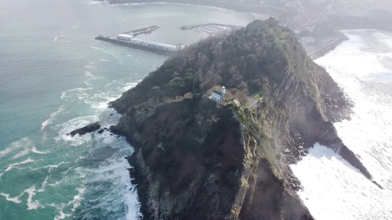
San Anton Island, Getaria. Basque Country
No reviews yet
Have you flown here? Share your experience with other pilots.
+ Write the first reviewDescription
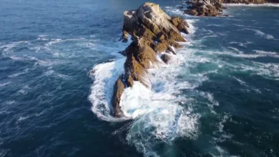
San Anton island in Getaria in the Basque Country. This can only be visited on foot
Map and restricted areas
Open in the main mapAviation weather (METAR and TAF)
LESO – San Sebastián Airport VFR
METAR
METAR LESO 210700Z 18005KT CAVOK 15/09 Q1016
- Wind
- 180°, 9 km/h
- Visibility
- 10 km or more
- Clouds
- –
- Temperature
- 15 °C, dew point 9 °C
- QNH
- 1016 hPa
- Flight category
- VFR: ceiling > 3,000 ft and visibility > 5 mi
TAF
TAF COR LESO 210541Z 2106/2206 19009KT 9999 SCT060 TX17/2113Z TN13/2206Z PROB30 TEMPO 2106/2114 RA PROB40 TEMPO 2110/2116 19015G25KT TEMPO 2114/2120 RA TEMPO 2119/2201 19019G29KT PROB40 TEMPO 2201/2206 26019G29KT 3000 RA BKN010
| Period (local time) | Change | Wind | Visibility | Weather | Clouds |
|---|---|---|---|---|---|
| 21/11 07:00 → 22/11 07:00 | Initial conditions | 190°, 17 km/h | 10 km or more | Scattered (3-4/8) at 6,000 ft (1830 m) | |
| 21/11 07:00 → 21/11 15:00 | Temporarily, probability 30% | Rain | |||
| 21/11 11:00 → 21/11 17:00 | Temporarily, probability 40% | 190°, 28 km/h, gusts 46 km/h | |||
| 21/11 15:00 → 21/11 21:00 | Temporarily | Rain | |||
| 21/11 20:00 → 22/11 02:00 | Temporarily | 190°, 35 km/h, gusts 54 km/h | |||
| 22/11 02:00 → 22/11 07:00 | Temporarily, probability 40% | 260°, 35 km/h, gusts 54 km/h | 3.0 km | Rain | Broken (5-7/8) at 1,000 ft (300 m) |
Weather and Kp index
| Day | Weather | Temp. min. / max. | Wind | Rain | Max Kp |
|---|---|---|---|---|---|
| Sat 21 Nov | Cloudy | 14° / 17° | 40 km/h S | 8.2 mm | 2 |
| Sun 22 Nov | Partly cloudy | 12° / 16° | 58 km/h W | 6.3 mm | 2 |
| Mon 23 Nov | Cloudy | 10° / 15° | 38 km/h W | 1.7 mm | 4 |
| Tue 24 Nov | Cloudy | 10° / 14° | 19 km/h S | 1.2 mm | 2 |
| Wed 25 Nov | Showers | 10° / 13° | 20 km/h SW | 6.5 mm | – |
| Thu 26 Nov | Showers | 8° / 12° | 21 km/h W | 3.4 mm | – |
| Fri 27 Nov | Cloudy | 9° / 14° | 22 km/h S | 0.1 mm | – |
Hour by hour: Saturday 21 November
| Time | Weather | Temp. | Wind | Rain | Clouds | Kp |
|---|---|---|---|---|---|---|
| 08:00 | Cloudy | 15° | 18 km/h S | – | 100 % | 2 |
| 09:00 | Cloudy | 15° | 20 km/h S | – | 100 % | 2 |
| 10:00 | Cloudy | 15° | 24 km/h S | – | 100 % | 2 |
| 11:00 | Cloudy | 16° | 23 km/h S | – | 99 % | 2 |
| 12:00 | Cloudy | 17° | 33 km/h S | – | 100 % | 2 |
| 13:00 | Cloudy | 17° | 39 km/h S | – | 100 % | 1 |
| 14:00 | Rain | 16° | 40 km/h S | 0.8 mm | 100 % | 1 |
| 15:00 | Heavy rain | 15° | 33 km/h S | 1.3 mm | 100 % | 1 |
| 16:00 | Heavy rain | 14° | 31 km/h S | 1.5 mm | 100 % | 2 |
| 17:00 | Heavy rain | 14° | 35 km/h S | 2.6 mm | 100 % | 2 |
| 18:00 | Heavy rain | 14° | 34 km/h S | 1.1 mm | 100 % | 2 |
| 19:00 | Cloudy | 14° | 32 km/h S | – | 100 % | 2 |
| 20:00 | Cloudy | 14° | 37 km/h S | – | 100 % | 2 |
| 21:00 | Rain | 15° | 36 km/h S | 0.6 mm | 100 % | 2 |
| 22:00 | Light rain | 14° | 37 km/h S | 0.3 mm | 100 % | 2 |
Hour by hour: Sunday 22 November
| Time | Weather | Temp. | Wind | Rain | Clouds | Kp |
|---|---|---|---|---|---|---|
| 06:00 | Clear sky | 14° | 45 km/h W | – | 2 % | 2 |
| 07:00 | Clear sky | 12° | 39 km/h SW | – | 6 % | 2 |
| 08:00 | Fair | 12° | 34 km/h SW | – | 13 % | 2 |
| 09:00 | Fair | 12° | 37 km/h SW | – | 27 % | 2 |
| 10:00 | Fair | 14° | 31 km/h SW | – | 30 % | 2 |
| 11:00 | Fair | 15° | 39 km/h W | – | 33 % | 2 |
| 12:00 | Fair | 16° | 40 km/h W | – | 38 % | 2 |
| 13:00 | Partly cloudy | 16° | 51 km/h W | – | 39 % | 2 |
| 14:00 | Showers | 16° | 55 km/h W | 0.1 mm | 40 % | 2 |
| 15:00 | Showers | 15° | 58 km/h W | 0.1 mm | 49 % | 2 |
| 16:00 | Fair | 15° | 44 km/h W | – | 37 % | 2 |
| 17:00 | Showers | 15° | 50 km/h W | 0.1 mm | 23 % | 2 |
| 18:00 | Fair | 14° | 46 km/h W | – | 28 % | 2 |
| 19:00 | Showers | 14° | 42 km/h W | 0.4 mm | 17 % | 2 |
| 20:00 | Showers | 13° | 42 km/h W | 0.4 mm | 51 % | 2 |
| 21:00 | Showers | 12° | 37 km/h W | 0.3 mm | 73 % | 2 |
| 22:00 | Light rain | 13° | 38 km/h W | 0.2 mm | 88 % | 2 |
Sunrise and sunset
| Day | Dawn | Sunrise | Golden hour | Sunset | Dusk | Day length |
|---|---|---|---|---|---|---|
| Sat 21 Nov | 07:38 | 08:10 | 08:10–08:53 · 16:56–17:40 | 17:40 | 18:11 | 9 h 30 |
| Sun 22 Nov | 07:40 | 08:11 | 08:11–08:55 · 16:55–17:39 | 17:39 | 18:10 | 9 h 28 |
| Mon 23 Nov | 07:41 | 08:12 | 08:12–08:56 · 16:54–17:38 | 17:38 | 18:10 | 9 h 26 |
| Tue 24 Nov | 07:42 | 08:13 | 08:13–08:58 · 16:53–17:38 | 17:38 | 18:09 | 9 h 24 |
| Wed 25 Nov | 07:43 | 08:14 | 08:14–08:59 · 16:53–17:37 | 17:37 | 18:09 | 9 h 22 |
| Thu 26 Nov | 07:44 | 08:16 | 08:16–09:00 · 16:52–17:37 | 17:37 | 18:08 | 9 h 21 |
| Fri 27 Nov | 07:45 | 08:17 | 08:17–09:02 · 16:51–17:36 | 17:36 | 18:08 | 9 h 19 |




Reviews
Log in to review this spot. Log in · Create a free account
No reviews yet. Share yours!