

Zarautz
No reviews yet
Have you flown here? Share your experience with other pilots.
+ Write the first reviewDescription
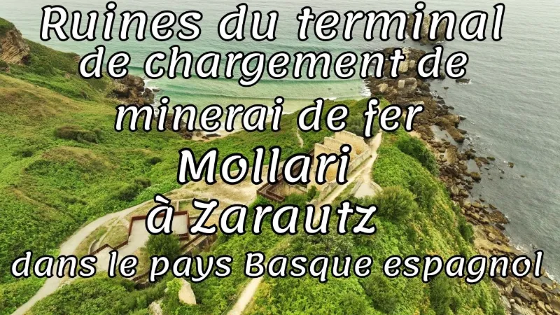
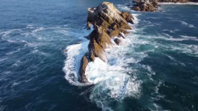
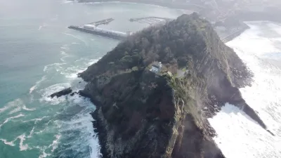
Built in 1906 under the direction of engineer Wilhelm Vahl Müller, this unique maritime terminal was meant to carry and export the iron extracted from the Andazarrate mines, located in Asteasu, more than 10 kilometres inland. The ore followed a technical route that was impressive for its time: • Aerial transport: The iron travelled in wagons hung from an 11-kilometre aerial cable, supported by 112 towers. • Storage: The wagons first arrived at a large stone warehouse built on top of the Talaimendi hill. • Loading at sea: From the warehouse, a second, shorter funicular lowered the ore over a distance of 300 metres (with a 35-metre drop) to a cantilever crane located on the rocky islet of Mollarri. This installation made it possible to pour the iron directly into the holds of ships anchored below. Because of mooring difficulties for boats and the whims of the sea, the pier ceased operations in 1923. Its metal structures were finally dismantled in the 1940s.
🚶♂️ How to get there today?
The site of Mollari - Malla Harriko mineral kargaleku zaharra has been nicely restored. Although you cannot go inside the old stone buildings, the outdoor route is dotted with information panels and wooden walkways that cross the Iñurritza biotope. To get there, you have two main options: 1. On foot from the beach (more strenuous): You can take the stairs at the foot of the Talaimendi hill, at the very end of Zarautz beach. Be careful, the climb has more than 400 steps, but the beauty of the coastal path is worth it. 2. By car (more accessible): You can park near the Gran Camping de Zarautz at the top of the hill and follow the gently sloping marked trail that goes down to the industrial remains. It is an ideal place to enjoy a sunset over the cliffs or to make a cultural stop if you are walking the Camino de Santiago (the Way of St. James to Santiago de Compostela), which passes through this area. If you plan to go, tell me if you are looking for: • A specific hiking route (such as the Anneau Vert-Bleu loop) • Good places to eat pintxos or fresh fish in the centre of Zarautz after your visit • Other historical remains or curiosities to discover nearby
Map and restricted areas
Open in the main mapAviation weather (METAR and TAF)
LESO – San Sebastián Airport VFR
METAR
METAR LESO 171200Z 00000KT 9999 BKN046 18/16 Q1004
- Wind
- Calm
- Visibility
- 10 km or more
- Clouds
- Broken (5-7/8) at 4,600 ft (1400 m)
- Temperature
- 18 °C, dew point 16 °C
- QNH
- 1004 hPa
- Flight category
- VFR: ceiling > 3,000 ft and visibility > 5 mi
TAF
TAF LESO 171100Z 1712/1812 24009KT 9999 FEW020 SCT060 TX22/1715Z TN15/1806Z TEMPO 1714/1803 23019G29KT PROB30 TEMPO 1803/1807 30010KT 3000 RA BKN010
| Period (local time) | Change | Wind | Visibility | Weather | Clouds |
|---|---|---|---|---|---|
| 17/11 13:00 → 18/11 13:00 | Initial conditions | 240°, 17 km/h | 10 km or more | Few (1-2/8) at 2,000 ft (610 m) ; Scattered (3-4/8) at 6,000 ft (1830 m) | |
| 17/11 15:00 → 18/11 04:00 | Temporarily | 230°, 35 km/h, gusts 54 km/h | |||
| 18/11 04:00 → 18/11 08:00 | Temporarily, probability 30% | 300°, 19 km/h | 3.0 km | Rain | Broken (5-7/8) at 1,000 ft (300 m) |
Weather and Kp index
| Day | Weather | Temp. min. / max. | Wind | Rain | Max Kp |
|---|---|---|---|---|---|
| Tue 17 Nov | Cloudy | 17° / 20° | 37 km/h SW | – | 5 |
| Wed 18 Nov | Clear sky | 13° / 20° | 40 km/h W | 6.7 mm | 5 |
| Thu 19 Nov | Clear sky | 11° / 17° | 53 km/h W | 6.8 mm | 3 |
| Fri 20 Nov | Partly cloudy | 12° / 17° | 18 km/h S | – | 3 |
| Sat 21 Nov | Light rain | 11° / 16° | 26 km/h S | 4.5 mm | – |
| Sun 22 Nov | Clear sky | 13° / 16° | 23 km/h S | 3.5 mm | – |
| Mon 23 Nov | Cloudy | 8° / 16° | 12 km/h S | – | – |
Hour by hour: Tuesday 17 November
| Time | Weather | Temp. | Wind | Rain | Clouds | Kp |
|---|---|---|---|---|---|---|
| 13:00 | Cloudy | 17° | 17 km/h NW | – | 100 % | 4 |
| 14:00 | Cloudy | 17° | 22 km/h E | – | 100 % | 4 |
| 15:00 | Cloudy | 18° | 27 km/h SW | – | 100 % | 4 |
| 16:00 | Cloudy | 20° | 23 km/h SW | – | 100 % | 4 |
| 17:00 | Cloudy | 20° | 30 km/h SW | – | 100 % | 4 |
| 18:00 | Cloudy | 20° | 22 km/h SW | – | 96 % | 4 |
| 19:00 | Cloudy | 17° | 20 km/h NE | – | 92 % | 5 |
| 20:00 | Cloudy | 17° | 23 km/h SE | – | 92 % | 5 |
| 21:00 | Cloudy | 18° | 23 km/h SW | – | 87 % | 5 |
| 22:00 | Cloudy | 19° | 23 km/h SW | – | 94 % | 5 |
Hour by hour: Wednesday 18 November
| Time | Weather | Temp. | Wind | Rain | Clouds | Kp |
|---|---|---|---|---|---|---|
| 06:00 | Heavy rain | 14° | 29 km/h W | 1.1 mm | 98 % | 4 |
| 07:00 | Heavy rain | 13° | 24 km/h SW | 1.2 mm | 98 % | 4 |
| 08:00 | Heavy rain | 13° | 24 km/h S | 1.2 mm | 100 % | 4 |
| 09:00 | Light rain | 14° | 20 km/h S | 0.4 mm | 100 % | 4 |
| 10:00 | Cloudy | 14° | 19 km/h S | – | 100 % | 4 |
| 11:00 | Partly cloudy | 15° | 22 km/h S | – | 63 % | 4 |
| 12:00 | Clear sky | 17° | 20 km/h S | – | 9 % | 4 |
| 13:00 | Clear sky | 18° | 14 km/h S | – | 2 % | 3 |
| 14:00 | Partly cloudy | 19° | 8 km/h NE | – | 39 % | 3 |
| 15:00 | Partly cloudy | 18° | 12 km/h NE | – | 83 % | 3 |
| 16:00 | Partly cloudy | 18° | 10 km/h NE | – | 100 % | 3 |
| 17:00 | Partly cloudy | 17° | 14 km/h E | – | 98 % | 3 |
| 18:00 | Partly cloudy | 16° | 18 km/h SE | – | 97 % | 3 |
| 19:00 | Cloudy | 18° | 21 km/h S | – | 97 % | 2 |
| 20:00 | Partly cloudy | 20° | 28 km/h SW | – | 93 % | 2 |
| 21:00 | Fair | 20° | 30 km/h SW | – | 18 % | 2 |
| 22:00 | Partly cloudy | 19° | 33 km/h SW | – | 52 % | 2 |
Sunrise and sunset
| Day | Dawn | Sunrise | Golden hour | Sunset | Dusk | Day length |
|---|---|---|---|---|---|---|
| Tue 17 Nov | 07:33 | 08:04 | 08:04–08:48 · 17:00–17:43 | 17:43 | 18:14 | 9 h 38 |
| Wed 18 Nov | 07:35 | 08:06 | 08:06–08:49 · 16:59–17:42 | 17:42 | 18:13 | 9 h 36 |
| Thu 19 Nov | 07:36 | 08:07 | 08:07–08:50 · 16:58–17:41 | 17:41 | 18:12 | 9 h 34 |
| Fri 20 Nov | 07:37 | 08:08 | 08:08–08:52 · 16:57–17:40 | 17:40 | 18:11 | 9 h 32 |
| Sat 21 Nov | 07:38 | 08:09 | 08:09–08:53 · 16:56–17:40 | 17:40 | 18:11 | 9 h 30 |
| Sun 22 Nov | 07:39 | 08:10 | 08:10–08:55 · 16:55–17:39 | 17:39 | 18:10 | 9 h 28 |
| Mon 23 Nov | 07:40 | 08:12 | 08:12–08:56 · 16:54–17:38 | 17:38 | 18:10 | 9 h 26 |



Reviews
Log in to review this spot. Log in · Create a free account
No reviews yet. Share yours!