

L'étang des forges
No reviews yet
Have you flown here? Share your experience with other pilots.
+ Write the first reviewDescription
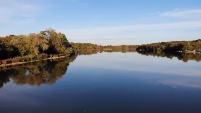
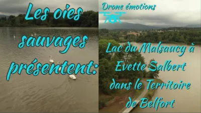
Compilation of my raw footage, a training flight made with my Mavic2 Zoom on August 8, 2022 over the étang des Forges, located at an altitude of 365 m, which fills a NE-SW oriented depression between the limestone relief of the Miotte hill (459 m) and the sandstone relief of Mont Rudolphe (494 m). 1160 m long and 360 m wide, it covers an area of 30 hectares across the communes of Belfort and Offemont.
The étang des Forges is fed with water by: - several streams born on Mont Rudolphe and coming from Offemont, - the Martinet canal, a diversion of the Savoureuse, the river that runs through Belfort, - small springs coming from the Miotte, - other springs located near the former swimming area of the pond, revealed when it was drained. Its outlet is the mill canal (or Forges canal), which joins the Savoureuse near the Espérance crossroads in Belfort.
Created in the Middle Ages in a wet, marshy lowland to serve as a food reserve and to offset water shortages, the "Grand Étang" became "l'étang de la Forge" in the 17th century to power a forge, and later "l'étang des Forges" after the forge was enlarged with the construction of two trip-hammer mills on the diversion canal. In 2002, it was declared to be of community interest.
The natural area
In the upstream part of the pond, the meadows, woods and wetlands are particularly remarkable. There you can find flora typical of wetlands: irises, meadowsweet, purple loosestrife, yellow loosestrife, rushes, sedges, etc., plant communities characterized by large populations of common reeds (reedbeds), groves of trees and shrubs, willows and alders, and a marshy alder grove. These areas, as well as the pond, are classified as a ZNIEFF (Natural Area of Ecological, Faunistic and Floristic Interest).
Many species, in particular marsh birds, nest in these wetlands or visit them regularly. The étang des Forges is also a corridor used by thousands of birds during their migration. It is also a feeding and wintering place for species coming from the Nordic countries or the East. To date, more than 150 bird species have been recorded at the étang des Forges.
The Roselière trail
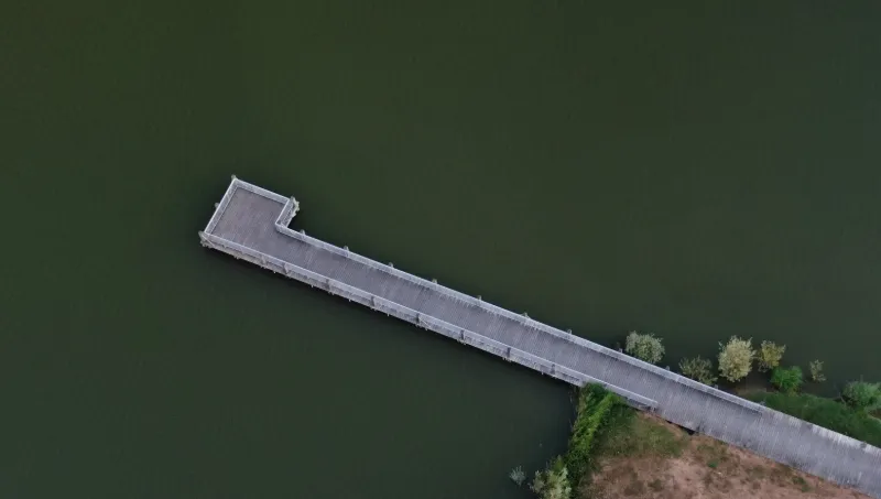
This trail, opened in June 1990, allows you to cross the wet or flooded areas thanks to three footbridges and to walk around the pond, while protecting the natural environment. It is also an educational trail, along which information panels about the fauna, flora and history of the site have been installed. Near the Roselière trail, an observatory lets you discover the birds of the pond.
Activities
The pond site offers many sports and leisure activities: - water activities, - running, hiking, mountain biking, - archery, - fishing.
An international campsite offers many tourists a place to stay at the gates of the city of Belfort.
Restoration work
Following the silting up of the pond due to the accumulation of sediment from the Offemont streams, the Martinet canal, and from the decomposition of organic matter, the Grand Belfort launched work to remove 165,000 m³ of sediment and thus restore an acceptable depth to the pond. Measures had previously been taken to limit silting: the creation of a first lagoon in the north-east of the site, on the Offemont stream, then a second lagoon installed where the Martinet canal enters. 18 months of work were needed to carry out the various restoration operations: site protection, fish recovery, draining, installation of a new hydraulic structure, drying of the sediment, dredging, removal of the sediment and its deposit at three sites, rehabilitation of the banks, and refilling with water.
Since the end of the work, regular measurements of mud depth and water quality have been carried out, along with a drain-down scheduled every four years and adjusted according to the thickness of the mud.
Map and restricted areas
Open in the main mapNearby aerodromes
Open aerodromes within 25 km of the spot, heliports included, with their distance and direction from the spot. Near an aerodrome, drone flying is prohibited or height-limited: check the UAS zones map.
| Aerodrome | Type | Distance | Elevation | Difference |
|---|---|---|---|---|
| Belfort Chaux Airfield | Aerodrome | 5.9 km NW | 417 m | spot 52 m lower |
| Montbéliard-Courcelles Airfield | Airport | 20 km S | 317 m | spot 47 m higher |
Aviation weather (METAR and TAF)
LFSM – Montbéliard-Courcelles Airfield MVFR
METAR
METAR LFSM 211100Z AUTO 24003KT 200V300 9999 -RA BKN013/// OVC023/// OVC040/// ///TCU 09/08 Q1020 RERA
- Wind
- 240°, 6 km/h
- Visibility
- 10 km or more
- Weather
- Rain light
- Clouds
- Broken (5-7/8) at 1,300 ft (400 m) ; Overcast (8/8) at 2,300 ft (700 m) ; Overcast (8/8) at 4,000 ft (1220 m)
- Temperature
- 9 °C, dew point 8 °C
- QNH
- 1020 hPa
- Flight category
- MVFR: ceiling 1,000–3,000 ft or visibility 3–5 mi
TAF
Weather and Kp index
Sunrise and sunset
| Day | Dawn | Sunrise | Golden hour | Sunset | Dusk | Day length |
|---|---|---|---|---|---|---|
| Sat 21 Nov | 07:12 | 07:47 | 07:47–08:36 · 16:01–16:50 | 16:50 | 17:24 | 9 h 03 |
| Sun 22 Nov | 07:14 | 07:48 | 07:48–08:37 · 16:00–16:49 | 16:49 | 17:24 | 9 h 01 |
| Mon 23 Nov | 07:15 | 07:49 | 07:49–08:39 · 15:59–16:48 | 16:48 | 17:23 | 8 h 59 |
| Tue 24 Nov | 07:16 | 07:51 | 07:51–08:40 · 15:58–16:48 | 16:48 | 17:22 | 8 h 56 |
| Wed 25 Nov | 07:18 | 07:52 | 07:52–08:42 · 15:57–16:47 | 16:47 | 17:21 | 8 h 54 |
| Thu 26 Nov | 07:19 | 07:53 | 07:53–08:44 · 15:56–16:46 | 16:46 | 17:21 | 8 h 52 |
| Fri 27 Nov | 07:20 | 07:55 | 07:55–08:45 · 15:55–16:46 | 16:46 | 17:20 | 8 h 50 |
Reviews
Log in to review this spot. Log in · Create a free account
No reviews yet. Share yours!