

Hartmannswiller, The Man-Eater

No reviews yet
Have you flown here? Share your experience with other pilots.
+ Write the first reviewDescription
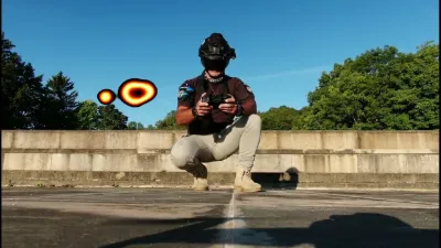
First 10-minute short film to promote my work as part of my search for a job as a drone remote pilot.
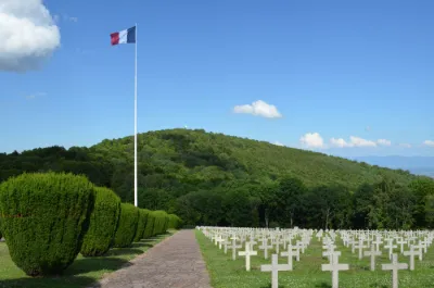
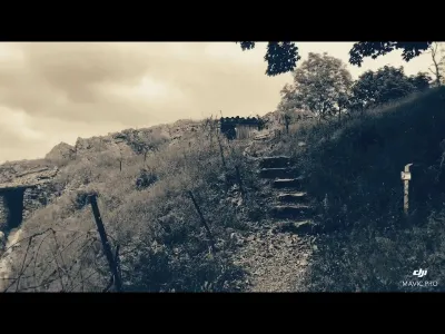
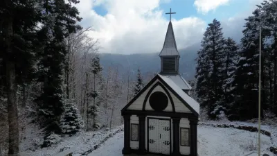
Made with the footage from my 2 flights on 5 and 12 September 2022 at sunrise; with no visitors present at this place steeped in history. ZP00039/ZP00040 Video available in 4K quality on YouTube.
Find all my videos at: https://www.skydrone4k.fr/dernieres-videos-4k-realisees Open to work : https://www.linkedin.com/in/skydrone4k/
Pascal JEANVOINE ED15622 CATT + Prat Pro + D.I.A ( 2021) 521 actual flights: 212 km covered / 49h of flight time On Mavic2 Zoom, Mavic Air / Mavic Pro / P4P
Feel free to send me your comments so I can improve, and to share this to give me more visibility. Thanks everyone.
Map and restricted areas
Open in the main mapNearby aerodromes
Open aerodromes within 25 km of the spot, heliports included, with their distance and direction from the spot. Near an aerodrome, drone flying is prohibited or height-limited: check the UAS zones map.
| Aerodrome | Type | Distance | Elevation | Difference |
|---|---|---|---|---|
| Centre Hospitalier De Moenchsberg Heliport | Heliport | 21 km SE | 329 m | spot 571 m higher |
| La Tête Des Champs Altiport | Aerodrome | 25 km W | 970 m | spot 70 m lower |
| Mulhouse-Habsheim Airfield | Aerodrome | 25 km SE | 240 m | spot 660 m higher |
Aviation weather (METAR and TAF)
LFGA – Colmar-Houssen Airport VFR
METAR
METAR LFGA 211100Z AUTO VRB02KT 9999 FEW013 BKN037 OVC043 08/06 Q1020
- Wind
- Variable, 4 km/h
- Visibility
- 10 km or more
- Clouds
- Few (1-2/8) at 1,300 ft (400 m) ; Broken (5-7/8) at 3,700 ft (1130 m) ; Overcast (8/8) at 4,300 ft (1310 m)
- Temperature
- 8 °C, dew point 6 °C
- QNH
- 1020 hPa
- Flight category
- VFR: ceiling > 3,000 ft and visibility > 5 mi
TAF
Weather and Kp index
| Day | Weather | Temp. min. / max. | Wind | Rain | Max Kp |
|---|---|---|---|---|---|
| Sat 21 Nov | Partly cloudy | 1° / 7° | 12 km/h SW | 0.1 mm | 2 |
| Sun 22 Nov | Sleet | -0° / 2° | 11 km/h N | 25 mm | 2 |
| Mon 23 Nov | Cloudy | -7° / 0° | 15 km/h N | 0.4 mm | 4 |
| Tue 24 Nov | Partly cloudy | -6° / -0° | 5 km/h NW | – | 2 |
| Wed 25 Nov | Partly cloudy | -4° / 0° | 6 km/h N | 0.6 mm | – |
| Thu 26 Nov | Cloudy | -5° / -3° | 6 km/h N | 1.4 mm | – |
| Fri 27 Nov | Cloudy | -4° / -0° | 6 km/h SW | 0.1 mm | – |
Hour by hour: Saturday 21 November
| Time | Weather | Temp. | Wind | Rain | Clouds | Kp |
|---|---|---|---|---|---|---|
| 12:00 | Showers | 7° | 11 km/h SW | 0.1 mm | 84 % | 2 |
| 13:00 | Partly cloudy | 6° | 12 km/h SW | – | 53 % | 1 |
| 14:00 | Partly cloudy | 7° | 12 km/h NW | – | 52 % | 1 |
| 15:00 | Partly cloudy | 7° | 11 km/h NW | – | 76 % | 1 |
| 16:00 | Partly cloudy | 6° | 6 km/h N | – | 56 % | 2 |
| 17:00 | Partly cloudy | 4° | 4 km/h N | – | 47 % | 2 |
| 18:00 | Cloudy | 3° | 3 km/h N | – | 88 % | 2 |
| 19:00 | Partly cloudy | 3° | 3 km/h NW | – | 85 % | 2 |
| 20:00 | Cloudy | 2° | 3 km/h NW | – | 88 % | 2 |
| 21:00 | Fog | 2° | 3 km/h NW | – | 98 % | 2 |
| 22:00 | Fog | 1° | 3 km/h NW | – | 98 % | 2 |
Hour by hour: Sunday 22 November
| Time | Weather | Temp. | Wind | Rain | Clouds | Kp |
|---|---|---|---|---|---|---|
| 06:00 | Fog | 2° | 4 km/h NE | – | 100 % | 2 |
| 07:00 | Light rain | 2° | 5 km/h N | 0.3 mm | 100 % | 2 |
| 08:00 | Rain | 2° | 4 km/h NW | 0.7 mm | 100 % | 2 |
| 09:00 | Heavy rain | 2° | 5 km/h N | 1.0 mm | 100 % | 2 |
| 10:00 | Heavy rain | 2° | 6 km/h W | 1.6 mm | 100 % | 2 |
| 11:00 | Sleet | 2° | 8 km/h S | 2.1 mm | 100 % | 2 |
| 12:00 | Sleet | 2° | 8 km/h SW | 2.3 mm | 100 % | 2 |
| 13:00 | Sleet | 1° | 8 km/h SW | 2.6 mm | 100 % | 2 |
| 14:00 | Snow | 1° | 7 km/h NE | 3.0 mm | 100 % | 2 |
| 15:00 | Snow | 0° | 8 km/h NE | 2.5 mm | 100 % | 2 |
| 16:00 | Snow | -0° | 10 km/h N | 2.1 mm | 100 % | 2 |
| 17:00 | Snow | -0° | 11 km/h N | 1.2 mm | 100 % | 2 |
| 18:00 | Snow | -0° | 10 km/h N | 1.4 mm | 100 % | 2 |
| 19:00 | Snow | -0° | 9 km/h N | 1.5 mm | 100 % | 2 |
| 20:00 | Snow | -0° | 10 km/h N | 1.1 mm | 100 % | 2 |
| 21:00 | Snow | -0° | 9 km/h N | 0.8 mm | 100 % | 2 |
| 22:00 | Snow | -0° | 8 km/h N | 0.4 mm | 100 % | 2 |
Sunrise and sunset
| Day | Dawn | Sunrise | Golden hour | Sunset | Dusk | Day length |
|---|---|---|---|---|---|---|
| Sat 21 Nov | 07:12 | 07:46 | 07:46–08:35 · 15:59–16:48 | 16:48 | 17:23 | 9 h 02 |
| Sun 22 Nov | 07:13 | 07:47 | 07:47–08:37 · 15:58–16:48 | 16:48 | 17:22 | 9 h 00 |
| Mon 23 Nov | 07:14 | 07:49 | 07:49–08:39 · 15:57–16:47 | 16:47 | 17:21 | 8 h 57 |
| Tue 24 Nov | 07:16 | 07:50 | 07:50–08:40 · 15:56–16:46 | 16:46 | 17:20 | 8 h 55 |
| Wed 25 Nov | 07:17 | 07:52 | 07:52–08:42 · 15:55–16:45 | 16:45 | 17:20 | 8 h 53 |
| Thu 26 Nov | 07:18 | 07:53 | 07:53–08:44 · 15:54–16:44 | 16:44 | 17:19 | 8 h 51 |
| Fri 27 Nov | 07:19 | 07:54 | 07:54–08:45 · 15:53–16:44 | 16:44 | 17:19 | 8 h 49 |

Reviews
Log in to review this spot. Log in · Create a free account
No reviews yet. Share yours!