

Sudel - Firstacker
No reviews yet
Have you flown here? Share your experience with other pilots.
+ Write the first reviewDescription
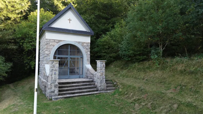
The Sudel is a chapel located on the Route des Crêtes in the Vosges. It is close to the Firstacker, which is a starting point for many hikes in the region. The Firstacker is also close to the Glashütte and the Judenhut, which are popular passes and summits for hikers. There are several hiking routes starting from the Firstacker, including the original loop on the eastern flank of the Grand Ballon, which passes through the Glashütte and the Judenhut before returning to the Firstacker. You can find more information about these hikes on LTD RANDO
Map and restricted areas
Open in the main mapNearby aerodromes
Open aerodromes within 25 km of the spot, heliports included, with their distance and direction from the spot. Near an aerodrome, drone flying is prohibited or height-limited: check the UAS zones map.
| Aerodrome | Type | Distance | Elevation | Difference |
|---|---|---|---|---|
| La Tête Des Champs Altiport | Aerodrome | 23 km W | 970 m | spot 6 m lower |
| Centre Hospitalier De Moenchsberg Heliport | Heliport | 24 km SE | 329 m | spot 635 m higher |
Aviation weather (METAR and TAF)
LFGA – Colmar-Houssen Airport VFR
METAR
METAR LFGA 211100Z AUTO VRB02KT 9999 FEW013 BKN037 OVC043 08/06 Q1020
- Wind
- Variable, 4 km/h
- Visibility
- 10 km or more
- Clouds
- Few (1-2/8) at 1,300 ft (400 m) ; Broken (5-7/8) at 3,700 ft (1130 m) ; Overcast (8/8) at 4,300 ft (1310 m)
- Temperature
- 8 °C, dew point 6 °C
- QNH
- 1020 hPa
- Flight category
- VFR: ceiling > 3,000 ft and visibility > 5 mi
TAF
Weather and Kp index
Sunrise and sunset
| Day | Dawn | Sunrise | Golden hour | Sunset | Dusk | Day length |
|---|---|---|---|---|---|---|
| Sat 21 Nov | 07:12 | 07:46 | 07:46–08:36 · 15:59–16:48 | 16:48 | 17:23 | 9 h 02 |
| Sun 22 Nov | 07:13 | 07:48 | 07:48–08:37 · 15:58–16:48 | 16:48 | 17:22 | 8 h 59 |
| Mon 23 Nov | 07:15 | 07:49 | 07:49–08:39 · 15:57–16:47 | 16:47 | 17:21 | 8 h 57 |
| Tue 24 Nov | 07:16 | 07:50 | 07:50–08:41 · 15:56–16:46 | 16:46 | 17:20 | 8 h 55 |
| Wed 25 Nov | 07:17 | 07:52 | 07:52–08:42 · 15:55–16:45 | 16:45 | 17:20 | 8 h 53 |
| Thu 26 Nov | 07:18 | 07:53 | 07:53–08:44 · 15:54–16:44 | 16:44 | 17:19 | 8 h 51 |
| Fri 27 Nov | 07:20 | 07:55 | 07:55–08:45 · 15:53–16:44 | 16:44 | 17:19 | 8 h 49 |


Reviews
Log in to review this spot. Log in · Create a free account
No reviews yet. Share yours!