

Sion Hill
Description
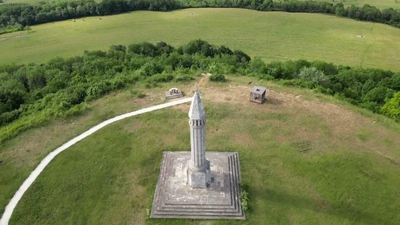
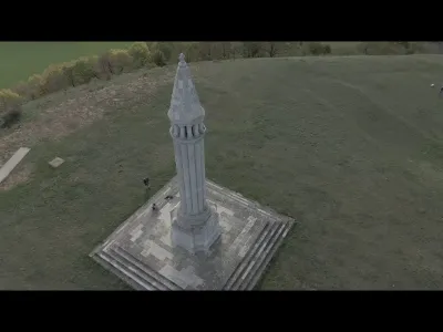
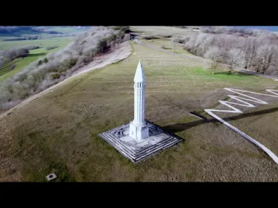
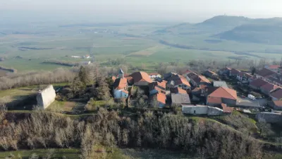
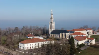
The Barrès monument, sometimes called the Barrès column, is a lantern of the dead inaugurated in 1928 on the Vaudémont signal, at the top of Sion hill, in honor of the writer Maurice Barrès, who had celebrated Sion hill in his novel La Colline inspirée. The monument is the work of the landscape architect Achille Duchêne, who drew heavily on the lantern of the dead at Fenioux. The monument stands on the Vaudémont signal, at the southern tip of Sion hill. It is the highest point of the hill and of the Lorraine plateau, at 540 or 541 meters altitude.
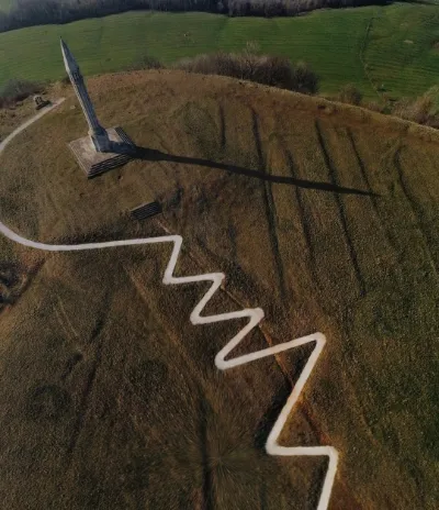
The monument is reached by a 270-meter-long zigzag path starting at the edge of departmental road 53. This road, which runs along the crest of the hill to link the villages of Sion and Vaudémont, is known as the route de la corniche Gaston Canel, after the civil engineer who designed it to serve the monument
Map and restricted areas
Open in the main mapNearby aerodromes
Open aerodromes within 25 km of the spot, heliports included, with their distance and direction from the spot. Near an aerodrome, drone flying is prohibited or height-limited: check the UAS zones map.
| Aerodrome | Type | Distance | Elevation | Difference |
|---|---|---|---|---|
| Épinal-Mirecourt Airport | Airport | 9.3 km S | 330 m | spot 207 m higher |
| Nancy-Ochey (BA 133) Air Base | Airport | 21 km NW | 337 m | spot 200 m higher |
| Pont St Vincent Airfield | Aerodrome | 21 km N | 398 m | spot 139 m higher |
| Nancy Azelot Airfield | Aerodrome | 24 km NE | 293 m | spot 244 m higher |
Aviation weather (METAR and TAF)
LFSG – Épinal-Mirecourt Airport VFR
METAR
METAR LFSG 211000Z AUTO 21003KT 9999 FEW006/// OVC038/// ///TCU 08/07 Q1019
- Wind
- 210°, 6 km/h
- Visibility
- 10 km or more
- Clouds
- Few (1-2/8) at 600 ft (180 m) ; Overcast (8/8) at 3,800 ft (1160 m)
- Temperature
- 8 °C, dew point 7 °C
- QNH
- 1019 hPa
- Flight category
- VFR: ceiling > 3,000 ft and visibility > 5 mi
TAF
Weather and Kp index
| Day | Weather | Temp. min. / max. | Wind | Rain | Max Kp |
|---|---|---|---|---|---|
| Sat 21 Nov | Cloudy | 3° / 9° | 9 km/h SW | 0.2 mm | 2 |
| Sun 22 Nov | Heavy rain | 2° / 5° | 15 km/h NE | 16 mm | 2 |
| Mon 23 Nov | Cloudy | -3° / 3° | 17 km/h NE | – | 4 |
| Tue 24 Nov | Clear sky | -4° / 3° | 15 km/h NE | – | 2 |
| Wed 25 Nov | Cloudy | -4° / 1° | 21 km/h NE | – | – |
| Thu 26 Nov | Cloudy | -3° / 0° | 13 km/h NE | – | – |
| Fri 27 Nov | Cloudy | 1° / 5° | 9 km/h S | 0.1 mm | – |
Hour by hour: Saturday 21 November
| Time | Weather | Temp. | Wind | Rain | Clouds | Kp |
|---|---|---|---|---|---|---|
| 11:00 | Cloudy | 7° | 9 km/h SW | – | 87 % | 2 |
| 12:00 | Partly cloudy | 8° | 9 km/h SW | – | 67 % | 2 |
| 13:00 | Cloudy | 9° | 8 km/h SW | – | 100 % | 1 |
| 14:00 | Light rain | 9° | 8 km/h SW | 0.2 mm | 100 % | 1 |
| 15:00 | Partly cloudy | 9° | 7 km/h SW | – | 44 % | 1 |
| 16:00 | Fair | 8° | 4 km/h S | – | 34 % | 2 |
| 17:00 | Fair | 6° | 5 km/h SE | – | 27 % | 2 |
| 18:00 | Fair | 6° | 6 km/h S | – | 26 % | 2 |
| 19:00 | Cloudy | 5° | 7 km/h S | – | 94 % | 2 |
| 20:00 | Cloudy | 5° | 6 km/h SE | – | 91 % | 2 |
| 21:00 | Fog | 4° | 5 km/h S | – | 99 % | 2 |
| 22:00 | Fog | 4° | 5 km/h SE | – | 98 % | 2 |
Hour by hour: Sunday 22 November
| Time | Weather | Temp. | Wind | Rain | Clouds | Kp |
|---|---|---|---|---|---|---|
| 06:00 | Fog | 3° | 10 km/h NE | – | 100 % | 2 |
| 07:00 | Light rain | 3° | 10 km/h NE | 0.3 mm | 100 % | 2 |
| 08:00 | Rain | 4° | 10 km/h E | 0.6 mm | 100 % | 2 |
| 09:00 | Heavy rain | 4° | 9 km/h E | 1.1 mm | 100 % | 2 |
| 10:00 | Heavy rain | 4° | 6 km/h NE | 1.8 mm | 100 % | 2 |
| 11:00 | Heavy rain | 4° | 9 km/h NE | 2.5 mm | 100 % | 2 |
| 12:00 | Heavy rain | 5° | 13 km/h NE | 2.5 mm | 100 % | 2 |
| 13:00 | Heavy rain | 5° | 14 km/h NE | 1.4 mm | 100 % | 2 |
| 14:00 | Rain | 5° | 15 km/h NE | 0.9 mm | 100 % | 2 |
| 15:00 | Heavy rain | 5° | 13 km/h NE | 1.0 mm | 100 % | 2 |
| 16:00 | Heavy rain | 5° | 13 km/h NE | 1.1 mm | 100 % | 2 |
| 17:00 | Rain | 4° | 15 km/h NE | 1.0 mm | 100 % | 2 |
| 18:00 | Rain | 4° | 14 km/h NE | 0.7 mm | 100 % | 2 |
| 19:00 | Light rain | 4° | 13 km/h N | 0.3 mm | 100 % | 2 |
| 20:00 | Light rain | 4° | 13 km/h N | 0.2 mm | 100 % | 2 |
| 21:00 | Light rain | 4° | 14 km/h N | 0.1 mm | 100 % | 2 |
| 22:00 | Cloudy | 3° | 14 km/h N | – | 100 % | 2 |
Sunrise and sunset
| Day | Dawn | Sunrise | Golden hour | Sunset | Dusk | Day length |
|---|---|---|---|---|---|---|
| Sat 21 Nov | 07:18 | 07:52 | 07:52–08:43 · 16:01–16:51 | 16:51 | 17:26 | 8 h 58 |
| Sun 22 Nov | 07:19 | 07:54 | 07:54–08:44 · 15:59–16:50 | 16:50 | 17:25 | 8 h 56 |
| Mon 23 Nov | 07:20 | 07:55 | 07:55–08:46 · 15:58–16:49 | 16:49 | 17:24 | 8 h 53 |
| Tue 24 Nov | 07:22 | 07:57 | 07:57–08:47 · 15:57–16:48 | 16:48 | 17:23 | 8 h 51 |
| Wed 25 Nov | 07:23 | 07:58 | 07:58–08:49 · 15:56–16:47 | 16:47 | 17:23 | 8 h 49 |
| Thu 26 Nov | 07:24 | 07:59 | 07:59–08:51 · 15:55–16:47 | 16:47 | 17:22 | 8 h 47 |
| Fri 27 Nov | 07:25 | 08:01 | 08:01–08:52 · 15:54–16:46 | 16:46 | 17:21 | 8 h 45 |

Reviews
Log in to review this spot. Log in · Create a free account
tyeb54230
Super Sympa