

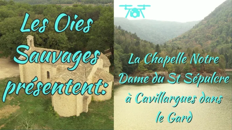
The Saint-Sépulcre chapel in Cavillargues
No reviews yet
Have you flown here? Share your experience with other pilots.
+ Write the first reviewDescription
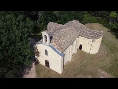
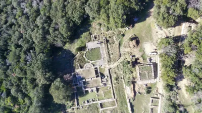
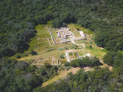
CHAPELLE DU SAINT-SÉPULCRE The hermitage of Notre-Dame-du-Saint-Sépulcre is a chapel of Romanesque origin, located in Cavillargues in the French department of Gard, in the Occitanie region.
Location The chapel stands isolated in the woods, a few hundred meters from the D166 departmental road, northeast of Cavillargues. The hermitage of Notre-Dame-du-Saint-Sépulcre dates from the 12th century. According to tradition, it was the knight Guillaume II de Sabran who had this chapel built with its hermitage, on his return from the First Crusade.
In the 15th century, it took the title of priory.
Having become too small, the chapel was enlarged in the 19th century. The two side chapels were added at that time.
It has been listed as a historic monument since March 2, 1981, except for the two side chapels dating from the 19th century. The original chapel is Romanesque in style. Its most remarkable features are its ribbed vaults and its half-dome vaults, inside the building.
Map and restricted areas
Open in the main mapNearby aerodromes
Open aerodromes within 25 km of the spot, heliports included, with their distance and direction from the spot. Near an aerodrome, drone flying is prohibited or height-limited: check the UAS zones map.
| Aerodrome | Type | Distance | Elevation | Difference |
|---|---|---|---|---|
| Uzès Airfield | Aerodrome | 12 km W | 270 m | spot 65 m lower |
| Aérodrome d'Avignon-Pujaut | Aerodrome | 23 km SE | 45 m | spot 159 m higher |
Aviation weather (METAR and TAF)
LFMO – Orange-Caritat (BA 115) Air Base VFR
METAR
METAR LFMO 210700Z AUTO 33004KT CAVOK 04/04 Q1020 NOSIG
- Wind
- 330°, 7 km/h
- Visibility
- 10 km or more
- Clouds
- –
- Temperature
- 4 °C, dew point 4 °C
- QNH
- 1020 hPa
- Flight category
- VFR: ceiling > 3,000 ft and visibility > 5 mi
TAF
TAF LFMO 210200Z 2103/2203 32003KT CAVOK TX16/2115Z TN05/2105Z PROB30 TEMPO 2122/2203 4000 -RA BECMG 2201/2203 13015G25KT
| Period (local time) | Change | Wind | Visibility | Weather | Clouds |
|---|---|---|---|---|---|
| 21/11 04:00 → 22/11 02:00 | Initial conditions | 320°, 6 km/h | 10 km or more | No significant cloud | |
| 21/11 23:00 → 22/11 04:00 | Temporarily, probability 30% | 4.0 km | Rain light | ||
| 22/11 02:00 → 22/11 04:00 | Becoming | 130°, 28 km/h, gusts 46 km/h | 10 km or more | No significant cloud |
Weather and Kp index
Sunrise and sunset
| Day | Dawn | Sunrise | Golden hour | Sunset | Dusk | Day length |
|---|---|---|---|---|---|---|
| Sat 21 Nov | 07:13 | 07:45 | 07:45–08:30 · 16:26–17:11 | 17:11 | 17:42 | 9 h 25 |
| Sun 22 Nov | 07:14 | 07:46 | 07:46–08:31 · 16:25–17:10 | 17:10 | 17:41 | 9 h 23 |
| Mon 23 Nov | 07:16 | 07:47 | 07:47–08:32 · 16:24–17:09 | 17:09 | 17:41 | 9 h 21 |
| Tue 24 Nov | 07:17 | 07:49 | 07:49–08:34 · 16:23–17:08 | 17:08 | 17:40 | 9 h 19 |
| Wed 25 Nov | 07:18 | 07:50 | 07:50–08:35 · 16:22–17:08 | 17:08 | 17:40 | 9 h 17 |
| Thu 26 Nov | 07:19 | 07:51 | 07:51–08:37 · 16:22–17:07 | 17:07 | 17:39 | 9 h 16 |
| Fri 27 Nov | 07:20 | 07:52 | 07:52–08:38 · 16:21–17:07 | 17:07 | 17:39 | 9 h 14 |
Reviews
Log in to review this spot. Log in · Create a free account
No reviews yet. Share yours!