

Port Grimaud
No reviews yet
Have you flown here? Share your experience with other pilots.
+ Write the first reviewDescription
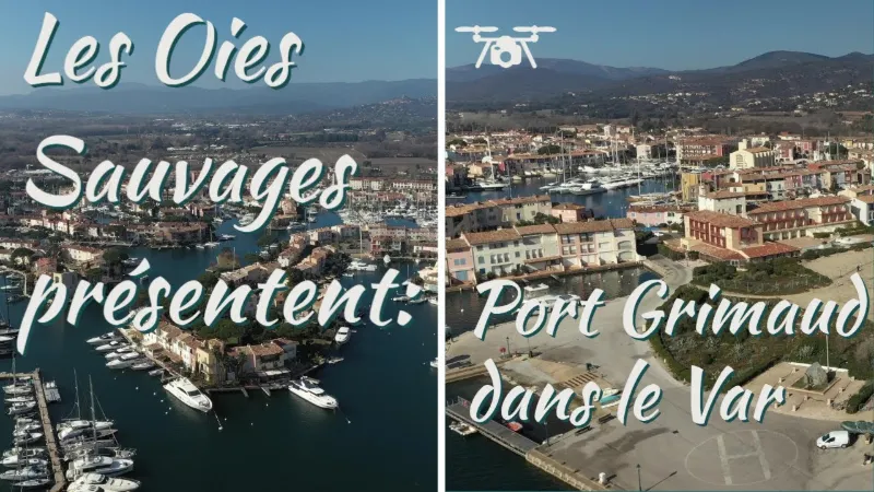
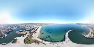
Port Grimaud, a special port in France Between Grimaud and the Mediterranean coast lies Port Grimaud. This port was built in 1960 and is called the Venice of the Côte d'Azur. Port Grimaud is very popular with tourists and there is always a certain buzz. It is a water village and each house has its own jetty. The atmosphere of Venice is recalled by the pretty houses and the vaulted galleries with their waterfront restaurants
Before 1960, this area was a marsh. The architect François Spoerry bought it to build a house on the water where he could moor his boat. It was from this idea that Port Grimaud was born. It became a village with bridges and canals where land and water intermingle, and Provençal-style houses with Mediterranean influences were built. In 2002, the village was recognized as a "20th-century heritage" site, with more than 2400 houses, 2000 boat moorings, 7 km of canals and 12 km of quays. This water village is largely closed to cars, with the barrier opening only for residents and renters. However, you can still enter if you want to stroll around on foot. There are cafés, bars and restaurants with terraces on the quays. Next to the church, there are boats for rent that you can use to sail the canals. It is on the water that you can best discover what makes Port Grimaud special.
Map and restricted areas
Open in the main mapNearby aerodromes
Open aerodromes within 25 km of the spot, heliports included, with their distance and direction from the spot. Near an aerodrome, drone flying is prohibited or height-limited: check the UAS zones map.
| Aerodrome | Type | Distance | Elevation | Difference |
|---|---|---|---|---|
| Base Hydro-ULM de St Tropez | Seaplane base | 1.8 km E | 0 m | same altitude as the spot |
| Sarl R.C.E Heliport | Heliport | 2.9 km W | 6 m | spot 6 m lower |
| Villa Salmanazar Helipad | Heliport | 9.9 km SE | 101 m | spot 101 m lower |
| La Môle Airport | Aerodrome | 11 km SW | 18 m | spot 18 m lower |
| Le Luc-Le Cannet Airport | Airport | 20 km NW | 81 m | spot 81 m lower |
Aviation weather (METAR and TAF)
LFMC – Le Luc-Le Cannet Airport VFR
METAR
METAR LFMC 210630Z AUTO 32012KT CAVOK 11/06 Q1018
- Wind
- 320°, 22 km/h
- Visibility
- 10 km or more
- Clouds
- –
- Temperature
- 11 °C, dew point 6 °C
- QNH
- 1018 hPa
- Flight category
- VFR: ceiling > 3,000 ft and visibility > 5 mi
TAF
Weather and Kp index
Sunrise and sunset
| Day | Dawn | Sunrise | Golden hour | Sunset | Dusk | Day length |
|---|---|---|---|---|---|---|
| Sat 21 Nov | 07:03 | 07:34 | 07:34–08:18 · 16:21–17:05 | 17:05 | 17:36 | 9 h 30 |
| Sun 22 Nov | 07:04 | 07:35 | 07:35–08:20 · 16:20–17:04 | 17:04 | 17:35 | 9 h 28 |
| Mon 23 Nov | 07:05 | 07:37 | 07:37–08:21 · 16:19–17:03 | 17:03 | 17:35 | 9 h 26 |
| Tue 24 Nov | 07:07 | 07:38 | 07:38–08:22 · 16:18–17:03 | 17:03 | 17:34 | 9 h 24 |
| Wed 25 Nov | 07:08 | 07:39 | 07:39–08:24 · 16:18–17:02 | 17:02 | 17:34 | 9 h 23 |
| Thu 26 Nov | 07:09 | 07:40 | 07:40–08:25 · 16:17–17:02 | 17:02 | 17:33 | 9 h 21 |
| Fri 27 Nov | 07:10 | 07:41 | 07:41–08:26 · 16:16–17:01 | 17:01 | 17:33 | 9 h 19 |




Reviews
Log in to review this spot. Log in · Create a free account
No reviews yet. Share yours!