

Loquirec
No reviews yet
Have you flown here? Share your experience with other pilots.
+ Write the first reviewDescription
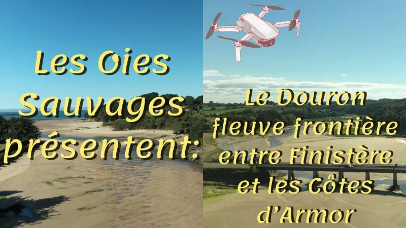
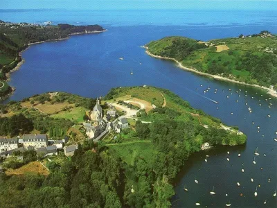
The Natura 2000 site "Rivière le Douron", located in the north of the Brittany region on the border between the Finistère and Côtes d'Armor departments, is partly part of the Douron watershed. Covering 2906 hectares, it extends over eleven communes, two of which are in Côtes-d'Armor. The Douron is the main watercourse and forms the departmental boundary downstream. Classified as a torrential river, it runs for nearly 38 kilometers, from its source at an altitude of 250 meters in peaty areas, to the Locquirec cove where it flows into the English Channel. Because of its border location, the site has undergone almost no human-made development, giving the whole valley a wild character and rich, diverse natural habitats. The landscapes take many forms and are home to several remarkable animal and plant species. Upstream, wet meadows and heathland dominate. Then, heading downstream, the valley becomes narrower and wooded. On the wooded slopes, broadleaf trees grow naturally, dominated by beech-oak forest, which is well represented on the site. Continuing on its course, the Douron shapes the valley, which opens out as far as the estuary, where salt meadows dominate, also very rich and well preserved.
This good state of conservation of the natural habitats and the presence on the site of animal species of Community interest, such as the European otter and the Atlantic salmon, enabled the site to join the Natura 2000 network and to be designated a special area of conservation (ministerial order of 4 May 2007).
Map and restricted areas
Open in the main mapNearby aerodromes
Open aerodromes within 25 km of the spot, heliports included, with their distance and direction from the spot. Near an aerodrome, drone flying is prohibited or height-limited: check the UAS zones map.
| Aerodrome | Type | Distance | Elevation | Difference |
|---|---|---|---|---|
| Centre Hospitalier Heliport | Heliport | 14 km NE | 28 m | spot 23 m lower |
| Morlaix-Ploujean Airport | Airport | 15 km SW | 83 m | spot 78 m lower |
| Lannion-Côte de Granit Airport | Airport | 15 km NE | 88 m | spot 84 m lower |
Aviation weather (METAR and TAF)
LFRO – Lannion-Côte de Granit Airport VFR
METAR
METAR LFRO 210700Z AUTO 14007KT CAVOK 05/05 Q1015
- Wind
- 140°, 13 km/h
- Visibility
- 10 km or more
- Clouds
- –
- Temperature
- 5 °C, dew point 5 °C
- QNH
- 1015 hPa
- Flight category
- VFR: ceiling > 3,000 ft and visibility > 5 mi
TAF
Weather and Kp index
| Day | Weather | Temp. min. / max. | Wind | Rain | Max Kp |
|---|---|---|---|---|---|
| Sat 21 Nov | Partly cloudy | 8° / 13° | 33 km/h SE | 2.8 mm | 2 |
| Sun 22 Nov | Cloudy | 10° / 12° | 57 km/h W | 5.9 mm | 2 |
| Mon 23 Nov | Partly cloudy | 10° / 14° | 42 km/h W | 0.3 mm | 4 |
| Tue 24 Nov | Partly cloudy | 6° / 10° | 29 km/h S | – | 2 |
| Wed 25 Nov | Cloudy | 4° / 7° | 18 km/h E | 1.7 mm | – |
| Thu 26 Nov | Fair | 3° / 6° | 15 km/h E | – | – |
| Fri 27 Nov | Cloudy | 3° / 12° | 24 km/h SE | 7.6 mm | – |
Hour by hour: Saturday 21 November
| Time | Weather | Temp. | Wind | Rain | Clouds | Kp |
|---|---|---|---|---|---|---|
| 08:00 | Fog | 8° | 18 km/h S | – | 100 % | 2 |
| 09:00 | Fog | 8° | 18 km/h S | – | 100 % | 2 |
| 10:00 | Fog | 9° | 19 km/h SE | – | 100 % | 2 |
| 11:00 | Fog | 10° | 21 km/h SE | – | 100 % | 2 |
| 12:00 | Cloudy | 11° | 22 km/h SE | – | 93 % | 2 |
| 13:00 | Partly cloudy | 12° | 24 km/h SE | – | 66 % | 1 |
| 14:00 | Cloudy | 13° | 27 km/h SE | – | 90 % | 1 |
| 15:00 | Partly cloudy | 13° | 28 km/h SE | – | 48 % | 1 |
| 16:00 | Fair | 13° | 26 km/h SE | – | 35 % | 2 |
| 17:00 | Partly cloudy | 12° | 27 km/h SE | – | 77 % | 2 |
| 18:00 | Cloudy | 12° | 32 km/h SE | – | 99 % | 2 |
| 19:00 | Cloudy | 12° | 32 km/h SE | – | 100 % | 2 |
| 20:00 | Light rain | 12° | 31 km/h SE | 0.2 mm | 99 % | 2 |
| 21:00 | Heavy rain | 11° | 32 km/h SE | 1.9 mm | 100 % | 2 |
| 22:00 | Rain | 11° | 33 km/h SE | 0.7 mm | 100 % | 2 |
Hour by hour: Sunday 22 November
| Time | Weather | Temp. | Wind | Rain | Clouds | Kp |
|---|---|---|---|---|---|---|
| 06:00 | Cloudy | 12° | 28 km/h SW | – | 93 % | 2 |
| 07:00 | Light rain | 11° | 32 km/h W | 0.3 mm | 100 % | 2 |
| 08:00 | Rain | 11° | 41 km/h W | 0.7 mm | 100 % | 2 |
| 09:00 | Rain | 11° | 52 km/h W | 0.7 mm | 100 % | 2 |
| 10:00 | Rain | 11° | 51 km/h W | 0.5 mm | 100 % | 2 |
| 11:00 | Heavy rain | 11° | 52 km/h W | 1.1 mm | 100 % | 2 |
| 12:00 | Rain | 10° | 53 km/h W | 0.4 mm | 100 % | 2 |
| 13:00 | Cloudy | 11° | 57 km/h W | – | 100 % | 2 |
| 14:00 | Cloudy | 12° | 54 km/h W | – | 100 % | 2 |
| 15:00 | Cloudy | 12° | 55 km/h W | – | 100 % | 2 |
| 16:00 | Cloudy | 12° | 54 km/h W | – | 100 % | 2 |
| 17:00 | Partly cloudy | 12° | 52 km/h W | – | 100 % | 2 |
| 18:00 | Cloudy | 12° | 50 km/h W | – | 100 % | 2 |
| 19:00 | Cloudy | 12° | 49 km/h W | – | 98 % | 2 |
| 20:00 | Partly cloudy | 11° | 48 km/h W | – | 77 % | 2 |
| 21:00 | Fair | 11° | 46 km/h W | – | 35 % | 2 |
| 22:00 | Fair | 11° | 44 km/h W | – | 31 % | 2 |
Sunrise and sunset
| Day | Dawn | Sunrise | Golden hour | Sunset | Dusk | Day length |
|---|---|---|---|---|---|---|
| Sat 21 Nov | 07:57 | 08:32 | 08:32–09:23 · 16:38–17:29 | 17:29 | 18:04 | 8 h 56 |
| Sun 22 Nov | 07:58 | 08:34 | 08:34–09:24 · 16:37–17:28 | 17:28 | 18:03 | 8 h 54 |
| Mon 23 Nov | 08:00 | 08:35 | 08:35–09:26 · 16:36–17:27 | 17:27 | 18:02 | 8 h 51 |
| Tue 24 Nov | 08:01 | 08:36 | 08:36–09:28 · 16:35–17:26 | 17:26 | 18:01 | 8 h 49 |
| Wed 25 Nov | 08:02 | 08:38 | 08:38–09:29 · 16:34–17:25 | 17:25 | 18:01 | 8 h 47 |
| Thu 26 Nov | 08:04 | 08:39 | 08:39–09:31 · 16:33–17:24 | 17:24 | 18:00 | 8 h 45 |
| Fri 27 Nov | 08:05 | 08:41 | 08:41–09:33 · 16:32–17:24 | 17:24 | 17:59 | 8 h 43 |





Reviews
Log in to review this spot. Log in · Create a free account
No reviews yet. Share yours!