

Le Cap du Rozel
No reviews yet
Have you flown here? Share your experience with other pilots.
+ Write the first reviewDescription
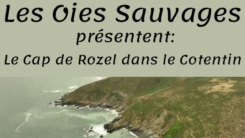
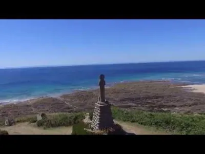
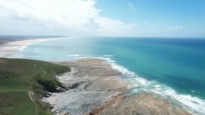
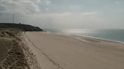
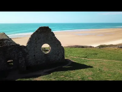
Cap du Rozel, located on the north-west coast of the Cotentin in Normandy, is a spectacular rocky headland overlooking the English Channel. This natural site offers an unobstructed view of the Sciotot cove to the north and the beaches of Surtainville to the south. Rising to 103 meters, it is topped by the statue **Maris Stella**, protector of sailors, erected in the 1950s. The cape can be reached via the customs officers' path, the GR 223, which runs along the cliffs. This place is also famous for its **archaeological excavations**, which revealed 80,000-year-old Neanderthal footprints. The surrounding dunes shelter remarkable biodiversity, including sea kale, a protected species. The landscape alternates between heathland, wet meadows and wild beaches. Cap du Rozel is a haven of peace for hikers, nature lovers and history enthusiasts. It bears witness both to the raw beauty of the Normandy coastline and to the richness of human heritage. A must-see site for an immersion between sea, sky and memory.
Map and restricted areas
Open in the main mapNearby aerodromes
Open aerodromes within 25 km of the spot, heliports included, with their distance and direction from the spot. Near an aerodrome, drone flying is prohibited or height-limited: check the UAS zones map.
| Aerodrome | Type | Distance | Elevation | Difference |
|---|---|---|---|---|
| Flamanville Heliport | Heliport | 7.3 km NW | 82 m | spot 34 m lower |
| Aérodrome de Vauville | Aerodrome | 16 km N | 139 m | spot 91 m lower |
| Crossma Heliport | Heliport | 24 km N | 147 m | spot 99 m lower |
| Centre Hospitalier Heliport | Heliport | 24 km NE | 19 m | spot 29 m higher |
| Arsenal-Premar Heliport | Heliport | 24 km NE | 8 m | spot 40 m higher |
Aviation weather (METAR and TAF)
LFRC – Cherbourg-Maupertus Airport LIFR
METAR
METAR LFRC 211130Z AUTO 15009KT 0350 0300 R28/0400N FG VV/// 09/09 Q1016 BECMG 6000 NSW BKN003
- Wind
- 150°, 17 km/h
- Visibility
- 350 m
- Weather
- Fog
- Clouds
- –
- Temperature
- 9 °C, dew point 9 °C
- QNH
- 1016 hPa
- Flight category
- LIFR: ceiling < 500 ft or visibility < 1 mi
TAF
TAF LFRC 211100Z 2112/2121 17010KT 0300 FG VV/// BECMG 2112/2114 6000 NSW BKN003 BECMG 2114/2116 BKN008 TEMPO 2116/2120 BKN011 BECMG 2119/2121 13015G25KT
| Period (local time) | Change | Wind | Visibility | Weather | Clouds |
|---|---|---|---|---|---|
| 21/11 13:00 → 21/11 22:00 | Initial conditions | 170°, 19 km/h | 300 m | Fog | |
| 21/11 13:00 → 21/11 15:00 | Becoming | 170°, 19 km/h | 6 km | No significant weather | Broken (5-7/8) at 300 ft (90 m) |
| 21/11 15:00 → 21/11 20:00 | Becoming | 170°, 19 km/h | 6 km | No significant weather | Broken (5-7/8) at 800 ft (240 m) |
| 21/11 17:00 → 21/11 21:00 | Temporarily | Broken (5-7/8) at 1,100 ft (340 m) | |||
| 21/11 20:00 → 21/11 22:00 | Becoming | 130°, 28 km/h, gusts 46 km/h | 6 km | No significant weather | Broken (5-7/8) at 800 ft (240 m) |
Weather and Kp index
Sunrise and sunset
| Day | Dawn | Sunrise | Golden hour | Sunset | Dusk | Day length |
|---|---|---|---|---|---|---|
| Sat 21 Nov | 07:52 | 08:28 | 08:28–09:20 · 16:27–17:19 | 17:19 | 17:54 | 8 h 50 |
| Sun 22 Nov | 07:53 | 08:29 | 08:29–09:21 · 16:26–17:18 | 17:18 | 17:53 | 8 h 48 |
| Mon 23 Nov | 07:55 | 08:31 | 08:31–09:23 · 16:24–17:17 | 17:17 | 17:53 | 8 h 46 |
| Tue 24 Nov | 07:56 | 08:32 | 08:32–09:25 · 16:23–17:16 | 17:16 | 17:52 | 8 h 43 |
| Wed 25 Nov | 07:58 | 08:34 | 08:34–09:27 · 16:22–17:15 | 17:15 | 17:51 | 8 h 41 |
| Thu 26 Nov | 07:59 | 08:35 | 08:35–09:28 · 16:21–17:14 | 17:14 | 17:50 | 8 h 39 |
| Fri 27 Nov | 08:00 | 08:36 | 08:36–09:30 · 16:20–17:13 | 17:13 | 17:50 | 8 h 36 |

Reviews
Log in to review this spot. Log in · Create a free account
No reviews yet. Share yours!