

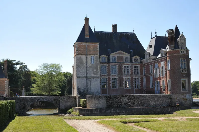
La Bussière Castle, Now the Fishing Museum
No reviews yet
Have you flown here? Share your experience with other pilots.
+ Write the first reviewHistory
Le corps de logis, d'origine médiévale, a été reconstruit vers le milieu du 16e siècle. De cette époque ne subsiste plus que les trois premiers niveaux du châtelet d'entrée. Suite aux destructions causées par les Protestants au cours des guerres de Religion, une nouvelle campagne de travaux fut entreprise vers 1600 qui concernait à la fois l'habitation et les communs. Au début du 18e siècle, une façade du corps de logis a été transformée tandis que deux pavillons d'entrée furent bâtis de part et d'autre d'une grille permettant l'accès au jardin. Au 19e siècle, des transformations importantes touchèrent surtout le corps de logis par l'adjonction de nouvelles constructions et la modification d'éléments existants. Les douves entourant les communs furent asséchées. Intervention attestée de l'architecte paysagiste René-Edouard André.
Map and restricted areas
Open in the main mapRestricted zones
Nearby aerodromes
Open aerodromes within 25 km of the spot, heliports included, with their distance and direction from the spot. Near an aerodrome, drone flying is prohibited or height-limited: check the UAS zones map.
| Aerodrome | Type | Distance | Elevation |
|---|---|---|---|
| Briare Chatillon Airport | Aerodrome | 15 km S | 164 m |
| Base ULM de Beaulieu-sur-Loire | Aerodrome | 22 km S | 135 m |
| Montargis Vimory Airport | Aerodrome | 24 km N | 94 m |
Aviation weather (METAR and TAF)
LFOZ – Orléans – Saint-Denis-de-l'Hôtel Airport MVFR
METAR
METAR LFOZ 171400Z AUTO 21019KT 9999 BKN030 15/11 Q0994
- Wind
- 210°, 35 km/h
- Visibility
- 10 km or more
- Clouds
- Broken (5-7/8) at 3,000 ft (910 m)
- Temperature
- 15 °C, dew point 11 °C
- QNH
- 994 hPa
- Flight category
- MVFR: ceiling 1,000–3,000 ft or visibility 3–5 mi
TAF
Weather and Kp index
Sunrise and sunset
| Day | Dawn | Sunrise | Golden hour | Sunset | Dusk | Day length |
|---|---|---|---|---|---|---|
| Tue 17 Nov | 07:24 | 07:58 | 07:58–08:46 · 16:22–17:10 | 17:10 | 17:44 | 9 h 12 |
| Wed 18 Nov | 07:25 | 07:59 | 07:59–08:48 · 16:21–17:09 | 17:09 | 17:43 | 9 h 10 |
| Thu 19 Nov | 07:26 | 08:00 | 08:00–08:49 · 16:20–17:08 | 17:08 | 17:42 | 9 h 07 |
| Fri 20 Nov | 07:28 | 08:02 | 08:02–08:51 · 16:18–17:07 | 17:07 | 17:41 | 9 h 05 |
| Sat 21 Nov | 07:29 | 08:03 | 08:03–08:53 · 16:17–17:06 | 17:06 | 17:41 | 9 h 03 |
| Sun 22 Nov | 07:30 | 08:05 | 08:05–08:54 · 16:16–17:06 | 17:06 | 17:40 | 9 h 00 |
| Mon 23 Nov | 07:32 | 08:06 | 08:06–08:56 · 16:15–17:05 | 17:05 | 17:39 | 8 h 58 |



Reviews (0)
Log in to review this spot. Log in · Create a free account
No reviews yet. Share yours!