

Saint-Lambert Castle and Church
No reviews yet
Have you flown here? Share your experience with other pilots.
+ Write the first reviewHistory
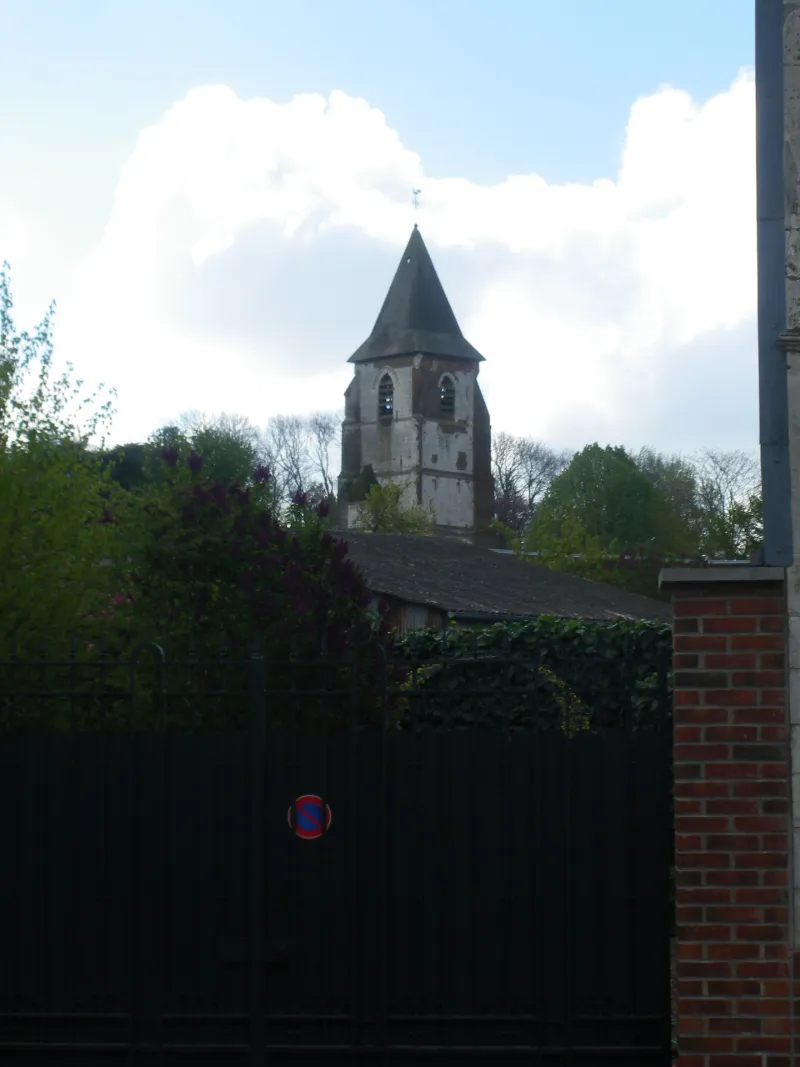
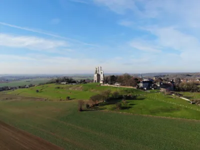
La seigneurie de Warlus est créée à la fin du 13e ou au début du 14e siècle. La construction du premier château, ou pavillon de chasse, remonterait à 1688. Plus tard, le bâtiment qui devait comporter plusieurs ailes, a été détruit par un incendie qui ne laissa qu'un corps de bâtiment, noyau de l'édifice actuel. Au 18e siècle, y résidait le régisseur de l'important domaine agricole. A la Révolution, le domaine est vendu comme bien national à un laboureur (1795). Au début du 19e siècle, la propriété appartient à un ancien entrepreneur qui a sans doute réalisé l'adjonction de deux ailes latérales (en pierre de taille) et du grand avant-corps central de la façade principale. La date de construction peut se situer sous la Restauration ou le début de la Monarchie de Juillet. Dans l'aile latérale gauche se trouve un salon circulaire avec quatre cheminées d'angles, surmontées de trumeaux de glace avec motifs décoratifs de scènes à l'Antique. Ce salon ferme l'enfilade des trois pièces du château primitif. Du début du 20e siècle datent les décors des pièces de l'ancien château donnant sur le parc. Pendant la Première guerre mondiale, le château servit de quartier général aux armées françaises. Il fut également utilisé au cours de la Seconde guerre mondiale. L'église est située dans l'enclos de la propriété et sa porte ouvre sur le village. Elle est composée d'une courte nef terminée par une abside à trois pans et précédée d'un clocher daté de 1550. Le choeur a été refait en 1777.
Map and restricted areas
Open in the main mapRestricted zones
| Zone | Category | Limits | Conditions |
|---|---|---|---|
| Zrt Opal | ZRT | From about 14,950 m to about 16,750 m above sea level | SUP AIP 233/24 · Du 16 janvier 2025 au 13 janvier 2027 |
Nearby aerodromes
Open aerodromes within 25 km of the spot, heliports included, with their distance and direction from the spot. Near an aerodrome, drone flying is prohibited or height-limited: check the UAS zones map.
| Aerodrome | Type | Distance | Elevation |
|---|---|---|---|
| Arras Roclincourt Airfield | Aerodrome | 11 km NE | 103 m |
| Polyclinique Heliport | Heliport | 20 km NE | 62 m |
| Lens Benifontaine Airfield | Aerodrome | 24 km NE | 51 m |
| Vitry en Artois Airfield | Aerodrome | 24 km E | 53 m |
Aviation weather (METAR and TAF)
LFAQ – Albert-Bray Airport VFR
METAR
METAR LFAQ 171400Z AUTO 23018KT 9999 BKN046 BKN056 OVC100 14/09 Q0987 TEMPO VRB30G40KT 4000 SHRA OVC012CB
- Wind
- 230°, 33 km/h
- Visibility
- 10 km or more
- Clouds
- Broken (5-7/8) at 4,600 ft (1400 m) ; Broken (5-7/8) at 5,600 ft (1710 m) ; Overcast (8/8) at 10,000 ft (3050 m)
- Temperature
- 14 °C, dew point 9 °C
- QNH
- 987 hPa
- Flight category
- VFR: ceiling > 3,000 ft and visibility > 5 mi
TAF
TAF LFAQ 171400Z 1715/1724 26020G30KT 9999 OVC030 TEMPO 1715/1724 4000 SHRA BKN020TCU PROB40 TEMPO 1715/1724 VRB30G40KT 2000 -TSRA OVC012CB PROB30 TEMPO 1716/1724 1400 -TSRAGS
| Period (local time) | Change | Wind | Visibility | Weather | Clouds |
|---|---|---|---|---|---|
| 17/11 16:00 → 18/11 01:00 | Initial conditions | 260°, 37 km/h, gusts 56 km/h | 10 km or more | Overcast (8/8) at 3,000 ft (910 m) | |
| 17/11 16:00 → 18/11 01:00 | Temporarily | 4.0 km | Showers of rain | Broken (5-7/8) at 2,000 ft (610 m) (towering cumulus) | |
| 17/11 16:00 → 18/11 01:00 | Temporarily, probability 40% | Variable, 56 km/h, gusts 74 km/h | 2.0 km | Thunderstorm rain light | Overcast (8/8) at 1,200 ft (370 m) (cumulonimbus) |
| 17/11 17:00 → 18/11 01:00 | Temporarily, probability 30% | 1.4 km | Thunderstorm rain light ; thunderstorm small hail light |
Weather and Kp index
| Day | Weather | Temp. min. / max. | Wind | Rain | Max Kp |
|---|---|---|---|---|---|
| Tue 17 Nov | Rain | 10° / 12° | 36 km/h SW | 14 mm | 5 |
| Wed 18 Nov | Showers | 8° / 11° | 35 km/h W | 8.0 mm | 5 |
| Thu 19 Nov | Light rain | 8° / 11° | 30 km/h W | 8.9 mm | 3 |
| Fri 20 Nov | Light rain | 9° / 11° | 25 km/h SW | 6.1 mm | 3 |
| Sat 21 Nov | Clear sky | 4° / 9° | 15 km/h NW | – | – |
| Sun 22 Nov | Rain | 2° / 6° | 15 km/h E | 4.8 mm | – |
| Mon 23 Nov | Clear sky | 4° / 11° | 18 km/h W | 0.5 mm | – |
Hour by hour: Tuesday 17 November
| Time | Weather | Temp. | Wind | Rain | Clouds | Kp |
|---|---|---|---|---|---|---|
| 15:00 | Rain | 12° | 33 km/h SW | 0.4 mm | 100 % | 4 |
| 16:00 | Heavy rain | 12° | 33 km/h SW | 3.1 mm | 100 % | 4 |
| 17:00 | Heavy rain | 10° | 26 km/h SW | 3.3 mm | 100 % | 4 |
| 18:00 | Heavy rain | 11° | 33 km/h SW | 3.6 mm | 100 % | 4 |
| 19:00 | Heavy rain | 11° | 36 km/h SW | 1.8 mm | 100 % | 5 |
| 20:00 | Rain | 10° | 36 km/h SW | 0.9 mm | 100 % | 5 |
| 21:00 | Light rain | 10° | 32 km/h SW | 0.3 mm | 88 % | 5 |
| 22:00 | Light rain | 10° | 33 km/h SW | 0.3 mm | 100 % | 5 |
Hour by hour: Wednesday 18 November
| Time | Weather | Temp. | Wind | Rain | Clouds | Kp |
|---|---|---|---|---|---|---|
| 06:00 | Light rain | 10° | 33 km/h SW | 0.3 mm | 100 % | 4 |
| 07:00 | Light rain | 10° | 32 km/h SW | 0.3 mm | 95 % | 4 |
| 08:00 | Light rain | 9° | 32 km/h SW | 0.4 mm | 100 % | 4 |
| 09:00 | Light rain | 10° | 32 km/h SW | 0.3 mm | 98 % | 4 |
| 10:00 | Rain | 10° | 32 km/h SW | 0.5 mm | 99 % | 4 |
| 11:00 | Rain | 10° | 31 km/h SW | 0.4 mm | 99 % | 4 |
| 12:00 | Rain | 10° | 33 km/h SW | 0.5 mm | 100 % | 4 |
| 13:00 | Showers | 11° | 35 km/h W | 0.3 mm | 83 % | 3 |
| 14:00 | Rain | 10° | 33 km/h W | 0.4 mm | 98 % | 3 |
| 15:00 | Light rain | 10° | 32 km/h W | 0.2 mm | 98 % | 3 |
| 16:00 | Partly cloudy | 10° | 27 km/h SW | – | 70 % | 3 |
| 17:00 | Showers | 10° | 26 km/h SW | 0.2 mm | 85 % | 3 |
| 18:00 | Light rain | 10° | 28 km/h SW | 0.2 mm | 98 % | 3 |
| 19:00 | Fair | 10° | 24 km/h SW | – | 35 % | 2 |
| 20:00 | Partly cloudy | 9° | 18 km/h SW | – | 82 % | 2 |
| 21:00 | Cloudy | 8° | 18 km/h S | – | 99 % | 2 |
| 22:00 | Rain | 9° | 21 km/h S | 0.4 mm | 99 % | 2 |
Sunrise and sunset
| Day | Dawn | Sunrise | Golden hour | Sunset | Dusk | Day length |
|---|---|---|---|---|---|---|
| Tue 17 Nov | 07:30 | 08:06 | 08:06–08:58 · 16:10–17:02 | 17:02 | 17:38 | 8 h 55 |
| Wed 18 Nov | 07:32 | 08:08 | 08:08–09:00 · 16:09–17:01 | 17:01 | 17:37 | 8 h 53 |
| Thu 19 Nov | 07:33 | 08:09 | 08:09–09:02 · 16:07–17:00 | 17:00 | 17:36 | 8 h 50 |
| Fri 20 Nov | 07:35 | 08:11 | 08:11–09:04 · 16:06–16:59 | 16:59 | 17:35 | 8 h 47 |
| Sat 21 Nov | 07:36 | 08:13 | 08:13–09:06 · 16:04–16:58 | 16:58 | 17:34 | 8 h 45 |
| Sun 22 Nov | 07:38 | 08:14 | 08:14–09:08 · 16:03–16:57 | 16:57 | 17:33 | 8 h 42 |
| Mon 23 Nov | 07:39 | 08:16 | 08:16–09:10 · 16:02–16:56 | 16:56 | 17:32 | 8 h 40 |

Reviews (0)
Log in to review this spot. Log in · Create a free account
No reviews yet. Share yours!