

Jersey
No reviews yet
Have you flown here? Share your experience with other pilots.
+ Write the first reviewDescription
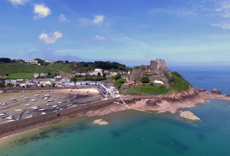
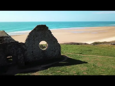
The site was already fortified in prehistoric times, but the castle was built in the 13th century as a means of defending the island. For three centuries it was considered invulnerable because it was surrounded by the sea on three sides. But the invention of gunpowder diminished its role to the benefit of the Elizabeth Castle off Saint-Hélier built in the 12th century. The governor of the time, Walter Raleigh, arguing that it could be used as a second line of defence, opposed its destruction, as the stones were supposed to be used for the construction of Elizabeth Castle.
The castle of Mont Orgueil served as a prison until the construction of the prison of Saint-Hélier.
Fortifications built by the Germans during their occupation of the island Starting in 1730, repairs were undertaken and made it possible to house garrisons. Until the mid-nineteenth century, it was open to the public on Easter Monday, a survival of the tradition of going to St George's Chapel inside the castle.
During the Second World War, the German occupying army erected additional camouflaged fortifications in harmony with the existing architecture.
Map and restricted areas
Open in the main mapAviation weather (METAR and TAF)
EGJJ – Jersey Airport LIFR
METAR
METAR EGJJ 211120Z 13013KT 0100 R08/0450D FG OVC000 09/09 Q1015
- Wind
- 130°, 24 km/h
- Visibility
- 100 m
- Weather
- Fog
- Clouds
- –
- Temperature
- 9 °C, dew point 9 °C
- QNH
- 1015 hPa
- Flight category
- LIFR: ceiling < 500 ft or visibility < 1 mi
TAF
TAF EGJJ 211112Z 2112/2121 13012KT 0200 FG BKN000 BECMG 2112/2114 9999 BKN008 PROB40 TEMPO 2112/2118 3000 BR BKN003 BECMG 2117/2119 SCT015
| Period (local time) | Change | Wind | Visibility | Weather | Clouds |
|---|---|---|---|---|---|
| 21/11 12:00 → 21/11 21:00 | Initial conditions | 130°, 22 km/h | 200 m | Fog | Broken (5-7/8) |
| 21/11 12:00 → 21/11 17:00 | Becoming | 130°, 22 km/h | 10 km or more | Fog | Broken (5-7/8) at 800 ft (240 m) |
| 21/11 12:00 → 21/11 18:00 | Temporarily, probability 40% | 3.0 km | Mist | Broken (5-7/8) at 300 ft (90 m) | |
| 21/11 17:00 → 21/11 21:00 | Becoming | 130°, 22 km/h | 10 km or more | Fog | Scattered (3-4/8) at 1,500 ft (460 m) |
Weather and Kp index
Sunrise and sunset
| Day | Dawn | Sunrise | Golden hour | Sunset | Dusk | Day length |
|---|---|---|---|---|---|---|
| Sat 21 Nov | 06:52 | 07:27 | 07:27–08:19 · 15:29–16:20 | 16:20 | 16:56 | 8 h 52 |
| Sun 22 Nov | 06:53 | 07:29 | 07:29–08:21 · 15:28–16:19 | 16:19 | 16:55 | 8 h 50 |
| Mon 23 Nov | 06:55 | 07:30 | 07:30–08:22 · 15:27–16:19 | 16:19 | 16:54 | 8 h 48 |
| Tue 24 Nov | 06:56 | 07:32 | 07:32–08:24 · 15:25–16:18 | 16:18 | 16:53 | 8 h 45 |
| Wed 25 Nov | 06:57 | 07:33 | 07:33–08:26 · 15:24–16:17 | 16:17 | 16:53 | 8 h 43 |
| Thu 26 Nov | 06:59 | 07:35 | 07:35–08:27 · 15:23–16:16 | 16:16 | 16:52 | 8 h 41 |
| Fri 27 Nov | 07:00 | 07:36 | 07:36–08:29 · 15:22–16:15 | 16:15 | 16:51 | 8 h 39 |

Reviews
Log in to review this spot. Log in · Create a free account
No reviews yet. Share yours!