

Spiaggia di Capo Comino - Siniscola
No reviews yet
Have you flown here? Share your experience with other pilots.
+ Write the first reviewDescription
Spiaggia di Capo Comino - Siniscola - Sardegna - Drone 4K/UHD - 2021
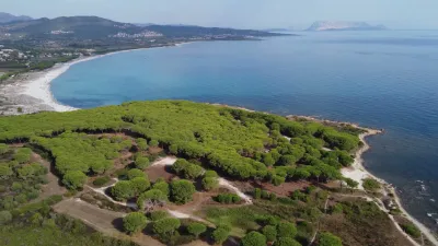
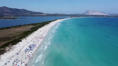
Capo Comino beach is one of the jewels of the long coastline of the Costa degli Oleandri. It is a large beach, about 2.6 kilometers long, with a shore of very fine light sand, dominated by imposing dunes that are a true natural treasure, and broken up by splendid cliffs. The vegetation is characterized by Mediterranean scrub shrubs, above all the centuries-old junipers, witnesses to the silent passing of time in the cove.
The waters of the beach are clear and in some spots turn an intense blue, which sets off the whiteness of the sand, and the seabed is shallow and sandy. Capo Comino is often swept by wind, which makes it well suited to windsurfing. A few hundred meters from the beach lies Ruja island, the "red island", a small islet of red porphyry that can be reached either on foot or by swimming.
Behind Capo Comino are the ponds of Salina Manna and Salinedda, where you can observe the typical, magnificent birdlife. The beauty of the place has made it the star of as many as three films. Not far from the coast lie the remains of a Roman fleet destroyed by a storm. Capo Comino beach has a very large car park and a bar.
Map and restricted areas
Open in the main mapAviation weather (METAR and TAF)
LIEO – Olbia Costa Smeralda Airport VFR
METAR
METAR LIEO 211050Z AUTO 24012KT 9999 // OVC160/// 17/11 Q1020
- Wind
- 240°, 22 km/h
- Visibility
- 10 km or more
- Clouds
- Overcast (8/8) at 16,000 ft (4880 m)
- Temperature
- 17 °C, dew point 11 °C
- QNH
- 1020 hPa
- Flight category
- VFR: ceiling > 3,000 ft and visibility > 5 mi
TAF
TAF LIEO 210500Z 2106/2206 28015KT 9999 FEW040 BECMG 2118/2120 VRB05KT
| Period (local time) | Change | Wind | Visibility | Weather | Clouds |
|---|---|---|---|---|---|
| 21/11 07:00 → 21/11 19:00 | Initial conditions | 280°, 28 km/h | 10 km or more | Few (1-2/8) at 4,000 ft (1220 m) | |
| 21/11 19:00 → 22/11 07:00 | Becoming | Variable, 9 km/h | 10 km or more | Few (1-2/8) at 4,000 ft (1220 m) |
Weather and Kp index
Sunrise and sunset
| Day | Dawn | Sunrise | Golden hour | Sunset | Dusk | Day length |
|---|---|---|---|---|---|---|
| Sat 21 Nov | 06:44 | 07:14 | 07:14–07:55 · 16:18–16:59 | 16:59 | 17:29 | 9 h 45 |
| Sun 22 Nov | 06:45 | 07:15 | 07:15–07:57 · 16:17–16:59 | 16:59 | 17:28 | 9 h 43 |
| Mon 23 Nov | 06:47 | 07:16 | 07:16–07:58 · 16:16–16:58 | 16:58 | 17:28 | 9 h 41 |
| Tue 24 Nov | 06:48 | 07:17 | 07:17–07:59 · 16:16–16:57 | 16:57 | 17:27 | 9 h 40 |
| Wed 25 Nov | 06:49 | 07:18 | 07:18–08:00 · 16:15–16:57 | 16:57 | 17:27 | 9 h 38 |
| Thu 26 Nov | 06:50 | 07:20 | 07:20–08:02 · 16:14–16:56 | 16:56 | 17:26 | 9 h 36 |
| Fri 27 Nov | 06:51 | 07:21 | 07:21–08:03 · 16:14–16:56 | 16:56 | 17:26 | 9 h 35 |

Reviews
Log in to review this spot. Log in · Create a free account
No reviews yet. Share yours!