

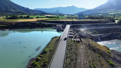
Serres, the dam.

No reviews yet
Have you flown here? Share your experience with other pilots.
+ Write the first reviewDescription
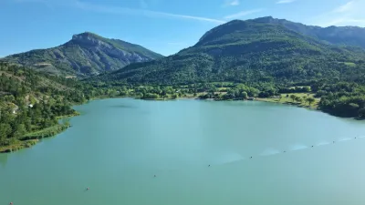
The Saint-Sauveur dam on the Buëch was built between 1990 and 1991 and commissioned in 1992 for hydroelectric power production and agricultural irrigation. During floods, the structure has been operated in transparency mode since its construction to limit sediment deposits in the reservoir as much as possible. Despite this transparency operation, the dam has had an impact on the transport of alluvial materials. To limit the phenomenon, the flood instruction was recently changed to optimize transparency for lower flows (from 120 m³/s to 100 m³/s, then 80 m³/s). A river contract was carried by the SMIGIBA from 2008 to 2017. A contract between the water agency and EDF has also been signed.
Map and restricted areas
Open in the main mapNearby aerodromes
Open aerodromes within 25 km of the spot, heliports included, with their distance and direction from the spot. Near an aerodrome, drone flying is prohibited or height-limited: check the UAS zones map.
| Aerodrome | Type | Distance | Elevation | Difference |
|---|---|---|---|---|
| Serres - La Bâtie-Montsaléon Airfield | Aerodrome | 6.9 km N | 715 m | spot 65 m lower |
| Altisurface du Grand Terrus | Aerodrome | 7.6 km NW | 875 m | spot 225 m lower |
| Aérodrome d'Aspres-sur-Buëch | Aerodrome | 14 km N | 831 m | spot 181 m lower |
| Aérodrome de Sistéron-Vaumeilh | Aerodrome | 20 km SE | 540 m | spot 110 m higher |
Aviation weather (METAR and TAF)
No METAR station within 50 km.
Weather and Kp index
Sunrise and sunset
| Day | Dawn | Sunrise | Golden hour | Sunset | Dusk | Day length |
|---|---|---|---|---|---|---|
| Sat 21 Nov | 07:09 | 07:41 | 07:41–08:26 · 16:20–17:05 | 17:05 | 17:37 | 9 h 24 |
| Sun 22 Nov | 07:10 | 07:42 | 07:42–08:27 · 16:19–17:04 | 17:04 | 17:36 | 9 h 22 |
| Mon 23 Nov | 07:11 | 07:43 | 07:43–08:29 · 16:18–17:04 | 17:04 | 17:35 | 9 h 20 |
| Tue 24 Nov | 07:13 | 07:45 | 07:45–08:30 · 16:17–17:03 | 17:03 | 17:35 | 9 h 18 |
| Wed 25 Nov | 07:14 | 07:46 | 07:46–08:32 · 16:16–17:02 | 17:02 | 17:34 | 9 h 16 |
| Thu 26 Nov | 07:15 | 07:47 | 07:47–08:33 · 16:16–17:02 | 17:02 | 17:34 | 9 h 14 |
| Fri 27 Nov | 07:16 | 07:48 | 07:48–08:34 · 16:15–17:01 | 17:01 | 17:33 | 9 h 12 |



Reviews
Log in to review this spot. Log in · Create a free account
No reviews yet. Share yours!