

Urville Nacqueville Beach
No reviews yet
Have you flown here? Share your experience with other pilots.
+ Write the first reviewDescription
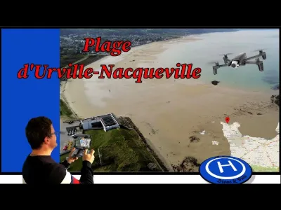
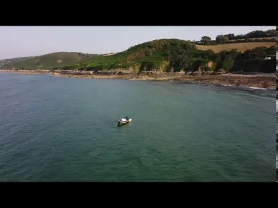
Urville-Nacqueville beach is a beach in La Hague, located in the former commune of Urville-Nacqueville. This fine sand beach stretches for three kilometers between Fort d'Urville and Landemer. It is split between La Charrière beach (to the east) and Les Quais beach (to the west), separated by a channel intended for dinghies. In 2015 and 2016, the British daily The Telegraph named it "the most beautiful French beach". Swimming is supervised in summer. Public toilets are nearby. A car park with 50 spaces is nearby. The streams of La Biale, La Digue and Le Caudar flow onto the beach. History: On 7 August 1758, an English squadron landed here to go and plunder Cherbourg. At the beginning of the 20th century, it was a popular holiday resort, particularly for people from Cherbourg, as shown by the villas along the shore. Starting in 2010, a Gallic necropolis was discovered at its far end. Source Wikimanche
Map and restricted areas
Open in the main mapNearby aerodromes
Open aerodromes within 25 km of the spot, heliports included, with their distance and direction from the spot. Near an aerodrome, drone flying is prohibited or height-limited: check the UAS zones map.
| Aerodrome | Type | Distance | Elevation | Difference |
|---|---|---|---|---|
| Arsenal-Premar Heliport | Heliport | 6.5 km SE | 8 m | spot 6 m lower |
| Centre Hospitalier Heliport | Heliport | 9.1 km SE | 19 m | spot 17 m lower |
| Aérodrome de Vauville | Aerodrome | 10 km SW | 139 m | spot 137 m lower |
| Crossma Heliport | Heliport | 14 km W | 147 m | spot 145 m lower |
| Cherbourg-Maupertus Airport | Airport | 18 km E | 140 m | spot 138 m lower |
Aviation weather (METAR and TAF)
LFRC – Cherbourg-Maupertus Airport MVFR
METAR
METAR LFRC 210630Z AUTO 18006KT 7000 NSC 05/05 Q1016 TEMPO 0300 FG VV///
- Wind
- 180°, 11 km/h
- Visibility
- 7 km
- Clouds
- –
- Temperature
- 5 °C, dew point 5 °C
- QNH
- 1016 hPa
- Flight category
- MVFR: ceiling 1,000–3,000 ft or visibility 3–5 mi
TAF
TAF LFRC 210500Z 2106/2115 VRB05KT 9999 SCT020 BECMG 2106/2108 15010KT 3000 BR BKN003 PROB40 TEMPO 2106/2110 0300 FG VV/// BECMG 2110/2112 9999 NSW BECMG 2113/2115 BKN006
| Period (local time) | Change | Wind | Visibility | Weather | Clouds |
|---|---|---|---|---|---|
| 21/11 07:00 → 21/11 16:00 | Initial conditions | Variable, 9 km/h | 10 km or more | Scattered (3-4/8) at 2,000 ft (610 m) | |
| 21/11 07:00 → 21/11 11:00 | Becoming | 150°, 19 km/h | 3.0 km | Mist | Broken (5-7/8) at 300 ft (90 m) |
| 21/11 07:00 → 21/11 11:00 | Temporarily, probability 40% | 300 m | Fog | ||
| 21/11 11:00 → 21/11 14:00 | Becoming | 150°, 19 km/h | 10 km or more | No significant weather | Broken (5-7/8) at 300 ft (90 m) |
| 21/11 14:00 → 21/11 16:00 | Becoming | 150°, 19 km/h | 10 km or more | No significant weather | Broken (5-7/8) at 600 ft (180 m) |
Weather and Kp index
Sunrise and sunset
| Day | Dawn | Sunrise | Golden hour | Sunset | Dusk | Day length |
|---|---|---|---|---|---|---|
| Sat 21 Nov | 07:52 | 08:28 | 08:28–09:20 · 16:25–17:17 | 17:17 | 17:53 | 8 h 49 |
| Sun 22 Nov | 07:54 | 08:30 | 08:30–09:22 · 16:24–17:16 | 17:16 | 17:52 | 8 h 46 |
| Mon 23 Nov | 07:55 | 08:31 | 08:31–09:24 · 16:23–17:16 | 17:16 | 17:52 | 8 h 44 |
| Tue 24 Nov | 07:56 | 08:32 | 08:32–09:26 · 16:22–17:15 | 17:15 | 17:51 | 8 h 42 |
| Wed 25 Nov | 07:58 | 08:34 | 08:34–09:27 · 16:20–17:14 | 17:14 | 17:50 | 8 h 39 |
| Thu 26 Nov | 07:59 | 08:35 | 08:35–09:29 · 16:19–17:13 | 17:13 | 17:49 | 8 h 37 |
| Fri 27 Nov | 08:00 | 08:37 | 08:37–09:31 · 16:18–17:12 | 17:12 | 17:49 | 8 h 35 |





Reviews
Log in to review this spot. Log in · Create a free account
No reviews yet. Share yours!